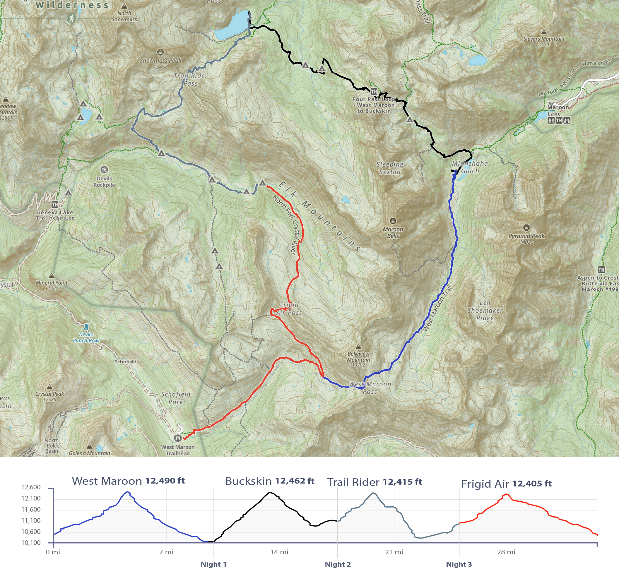
In July and August of this year, I was lucky enough to spend four days backpacking the spectacular Four Pass Loop in Maroon Bells-Snowmass Wilderness near Aspen, Colorado. This popular loop route gets its name from the four 12K feet passes one has to traverse to complete.
Overview
When // July 30, 2022 to August 2, 2022
Where // Maroon Bells-Snowmass Wilderness Area located in the Elk Mountains of central Colorado. Between Crested Butte and Aspen.
Distance hiked and Elevation // Roughly 34 miles with just over 8,900 feet ascent.
Difficulty // It’s a difficult trip for the average hiker especially if you’re coming from sea level and not acclimated. It helps to take it slow and do one pass per day versus cramming it all in to a one or two nighter. Showing up with decent fitness certainly helps make this trip more manageable. This loop would be really fun to do as a trail run if you were trained for it.
Conditions // Temperatures were perfect for hiking with lows being in the upper 40’s and highs in the mid-to-upper 70’s. It was monsoon season so days started relatively nice before clouds and/or rain moved in early to mid afternoon. Driving rain and hail late the second day. Trails were in good shape and overall were not too technical outside of the steep sections around the passes. Plenty of water so I didn’t carry more than 1.5 liters. Campsites were plentiful and the few I stayed at had streams nearby.
Planning
Logistics // I started from the Crested Butte side at West Maroon Trailhead accessed from Schofield Pass Road FSR #317. The more popular Aspen side has a parking permit system which in my case wasn’t ideal because I wanted the flexibility and convenience of finishing whenever. I had plenty of time so wanted to take everything at a slower pace.
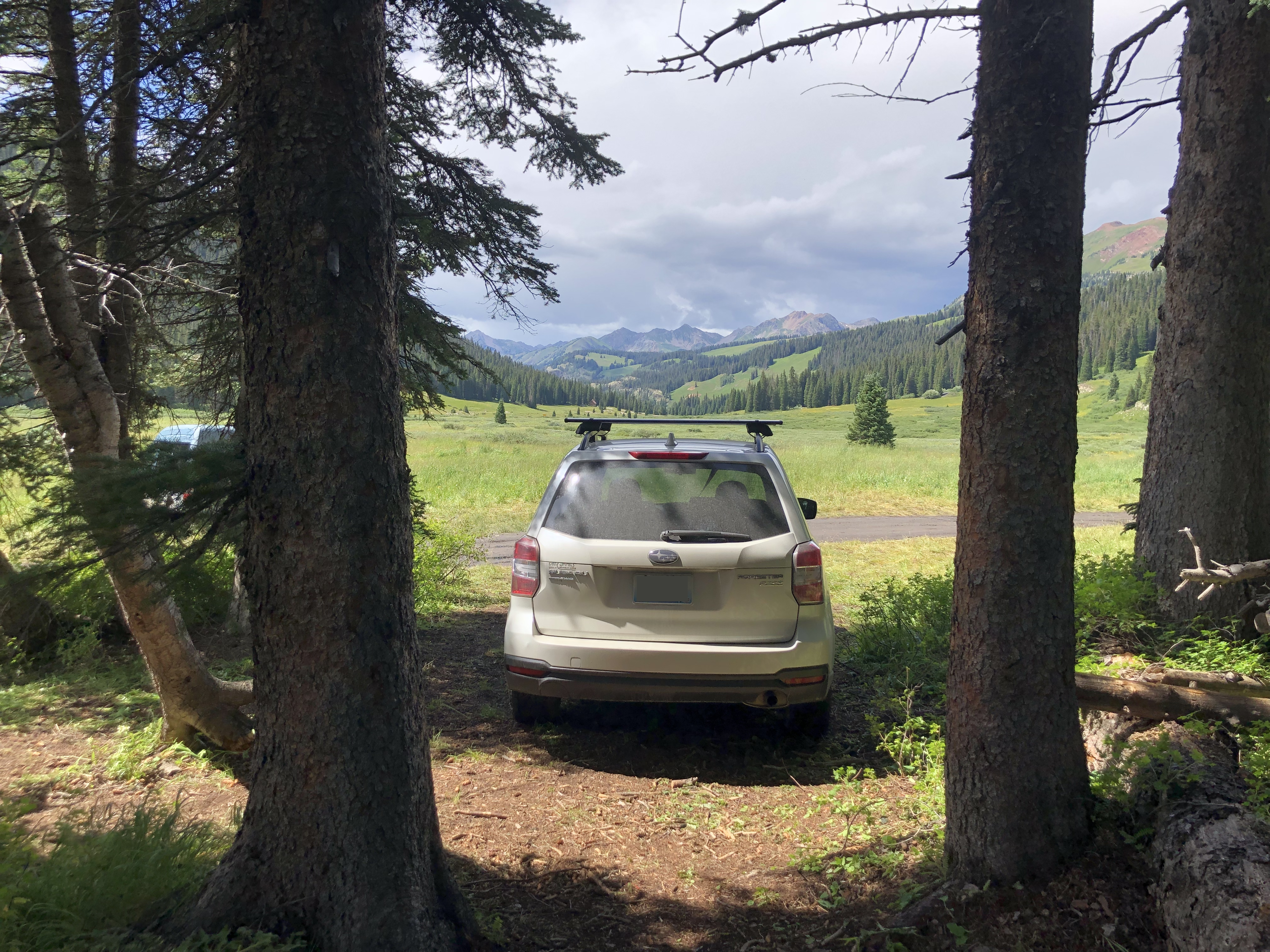
Note on FSR #317 // This road has a reputation for being rugged, difficult, and even deadly especially the section between Schofield Park and the Devil’s Punchbowl. This said, the section from Mt Crested Butte to the trailhead was fairly straight forward for a 2016 Suburu Forester as the trailhead is located just over Schofield Pass and before the road gets sketch. Only tricky part was the narrow shelf section around Emerald Lake where there is a large drop off. Go slow, be aware of other vehicles (including mountain bikers), and take account of the passing areas as you progress forward.
Note on altitude // Most of the trail is over 10K feet so you’ll want to be mindful of altitude sickness. If you’re visiting from sea level, I highly recommend spending a few days at higher elevation before you go as well as hydrating with plenty of electrolytes in the days leading up to your trip.
Gear considerations // I opted for the ground rig over hammock as it’s the most versatile setup and is well suited for sparse alpine landscapes. It’s also less weight. Bear cans are required in Maroon Bells-Snowmass Wilderness so I carried a Blazer Bearikade. Definitely bring rain gear. I carried too much camera gear which I didn’t include in the LighterPack.
The Hike
I decided to move counter-clockwise for two reasons: one I thought that would be the direction least traveled and therefore would make finding camp easier; and two I liked the idea of starting with the longer valley descent into night one near Crater Lake. Went okay as there were still tons of people, but I was able to find camp due to arriving earlier than other CCW hikers and the valley descent was pretty nice to start with. In my humble opinion, the views going CCW were better ;)
Day 1
Distance // 9.58 miles
Ascent // 2,323 feet
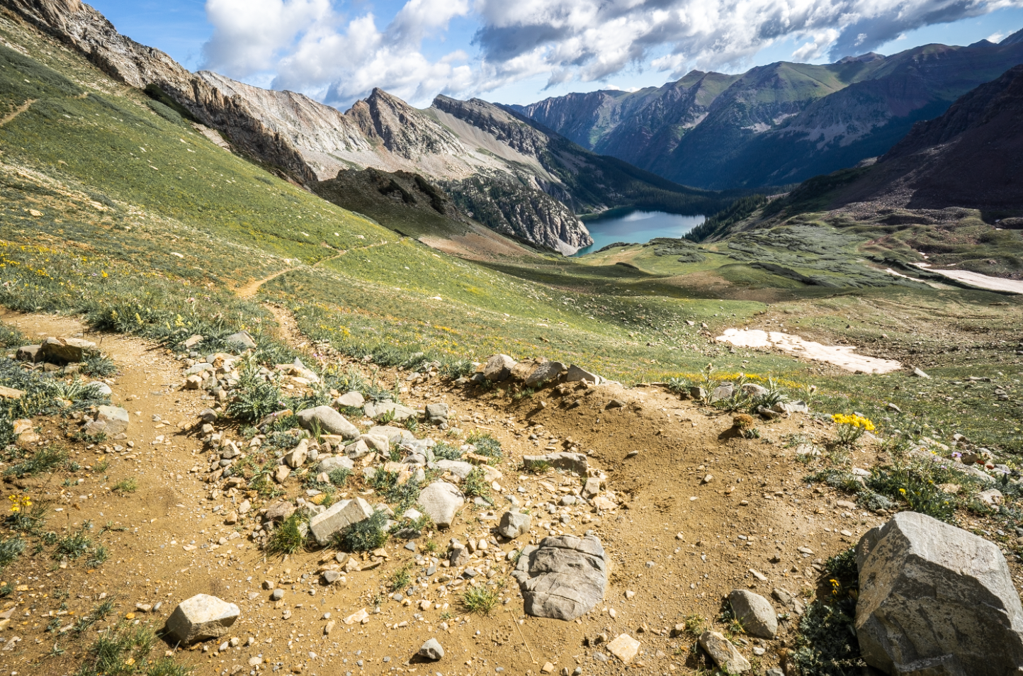
Points of interest // West Maroon Pass (12,4902 ft elevation), Crater Lake
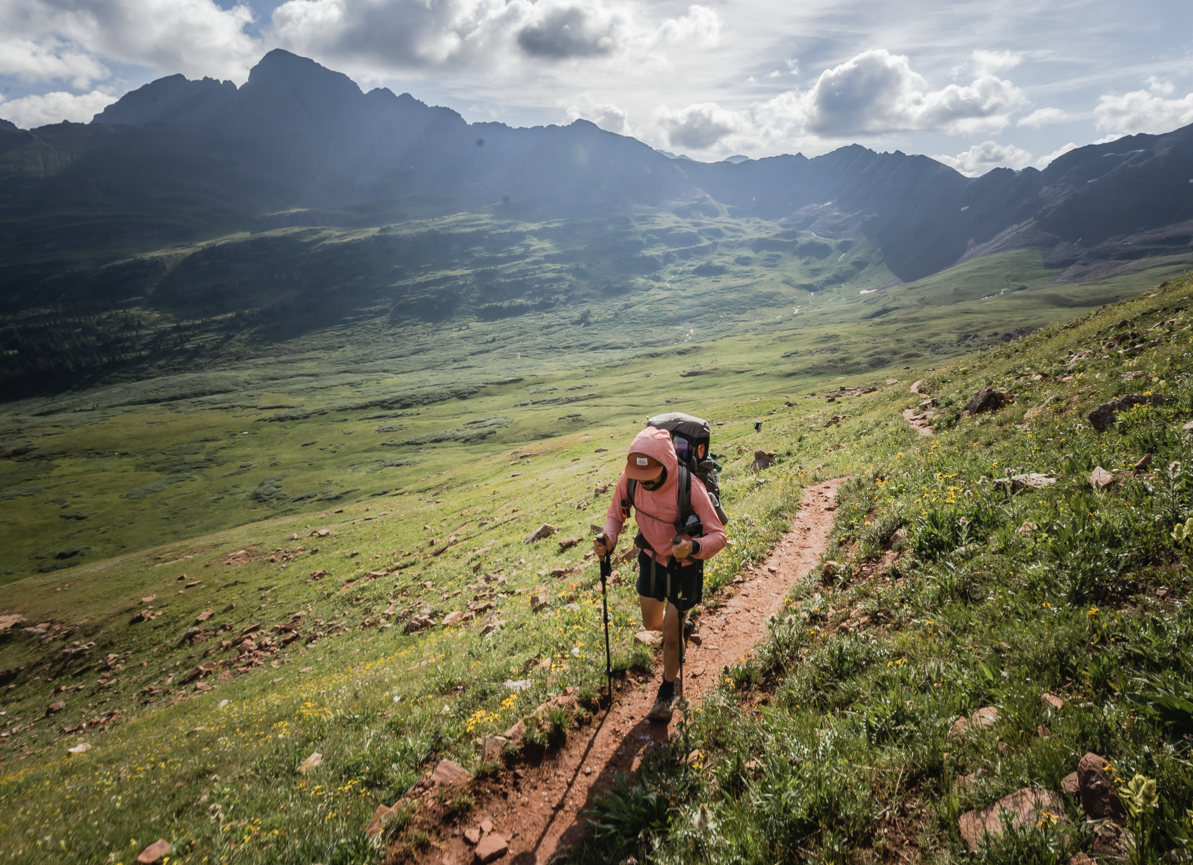
I started my journey from the Crested Butte West Maroon Trailhead before 8 after packing the rest of what I thought I needed from the vehicle. Before taking off, I filled out a permit tag and dropped the white copy in the box. Any group entering the wilderness area must do this.
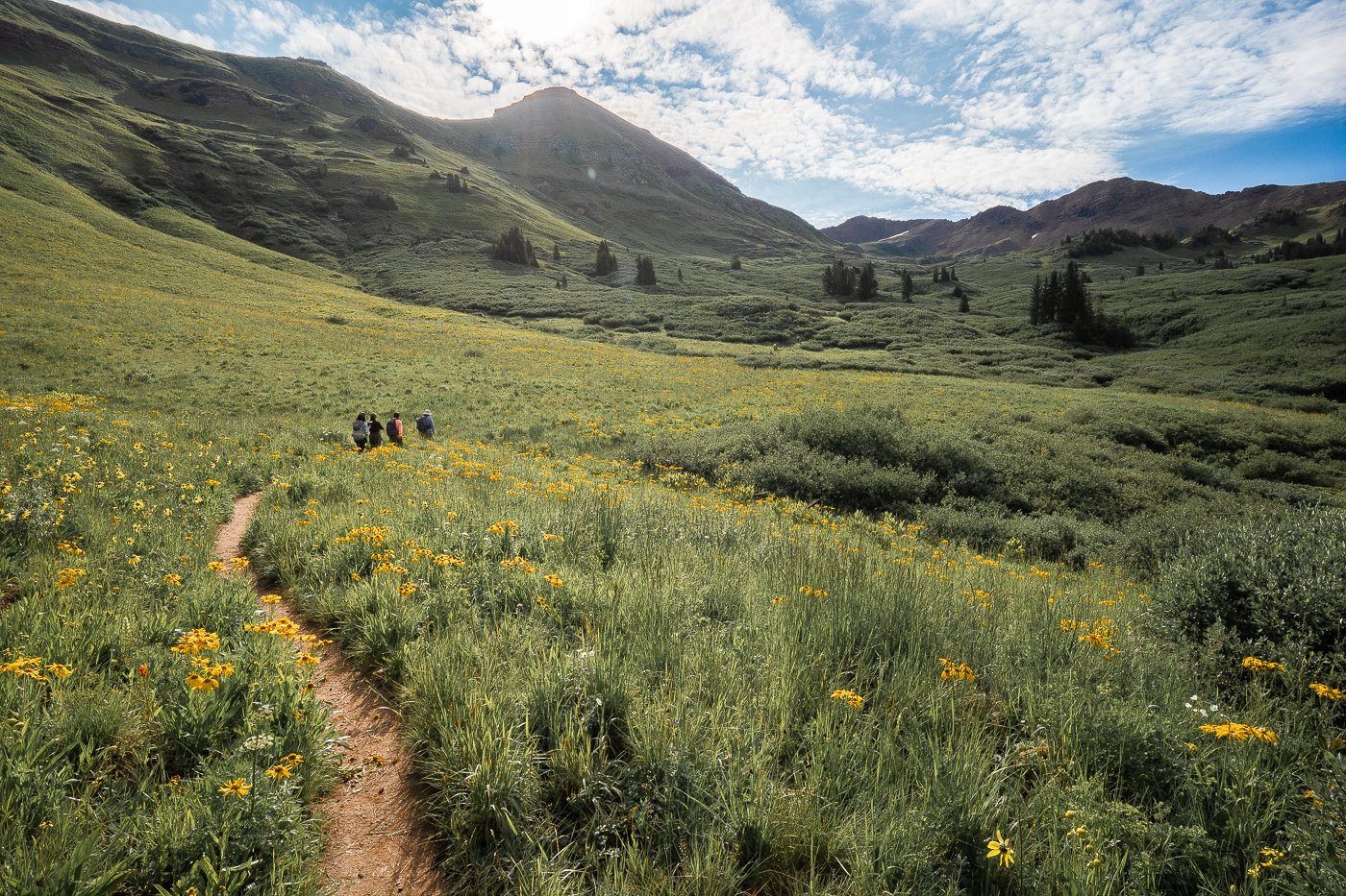
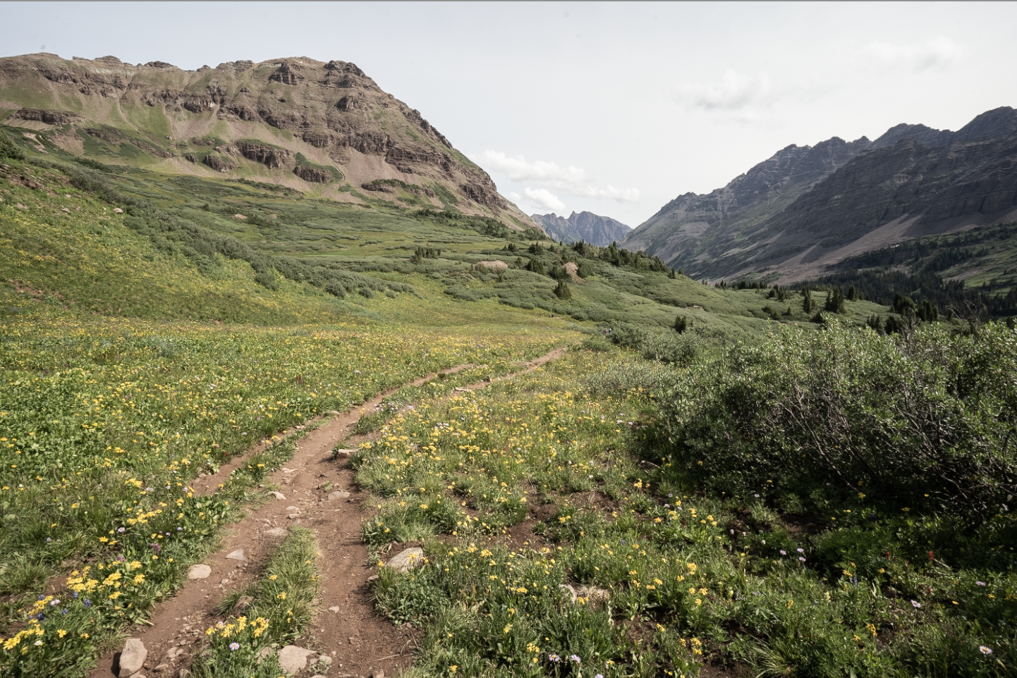
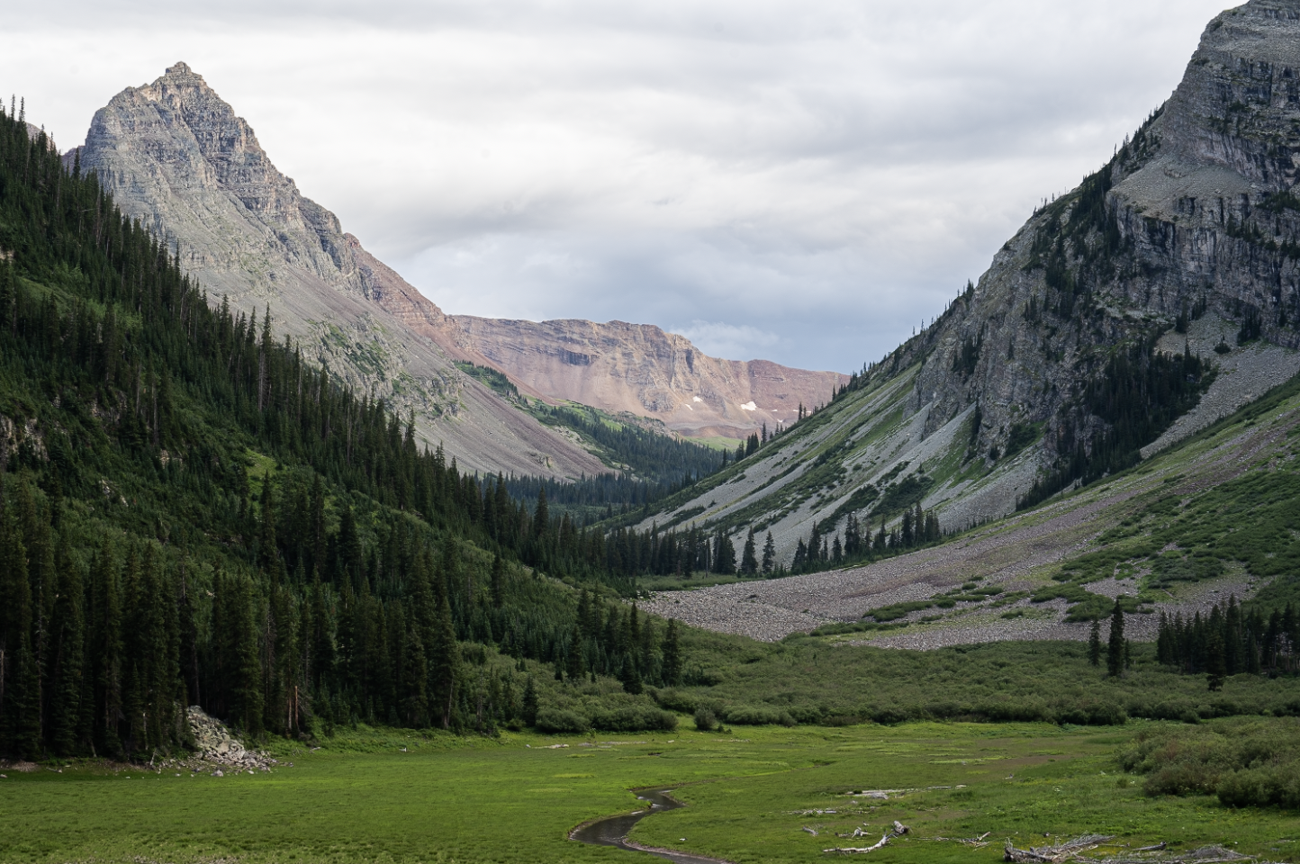
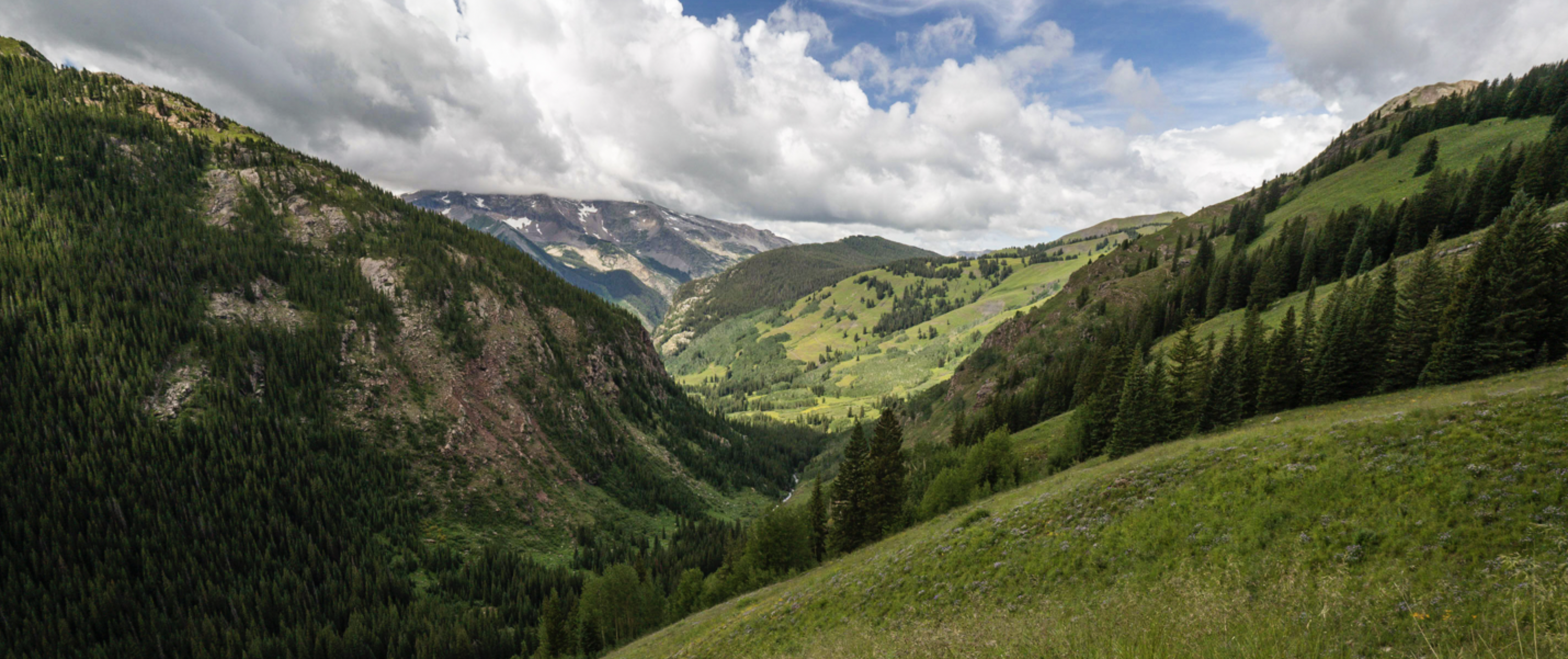
Weather was partly cloudy and beautiful. Lungs and heart fired up for the day as I hiked up West Maroon Trail through and out of coniferous woods. After 3-ish miles, I came to the junction where Trail North Fork Crystal River Trail terminates at West Maroon Trail which is where the loop starts. I stayed on West Maroon Trail heading towards the first of the four passes, West Maroon. I walked through lush meadows speckled with yellow wildflowers before slowly making my way up a dry alpine drainage bed mostly stair stepping closer to the pass.
As I approached the pass, it was slower going as the terrain became quite steep and footing less secure due to large amounts of scree and loose rock. Shortly after arriving atop the pass, I enjoyed the views over a protein bar before starting the valley descent on the other side.
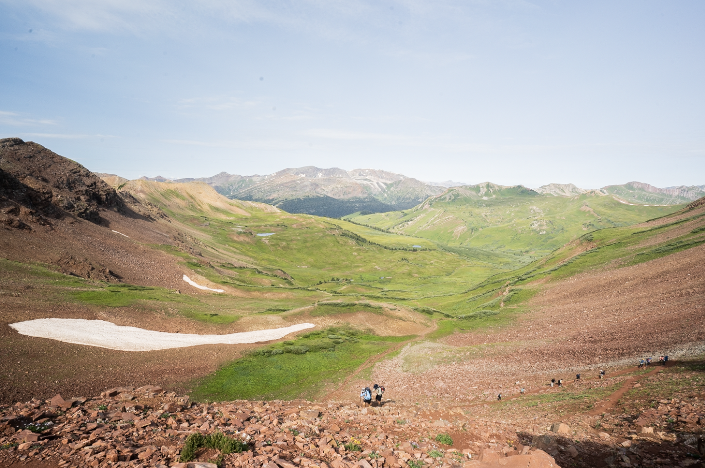
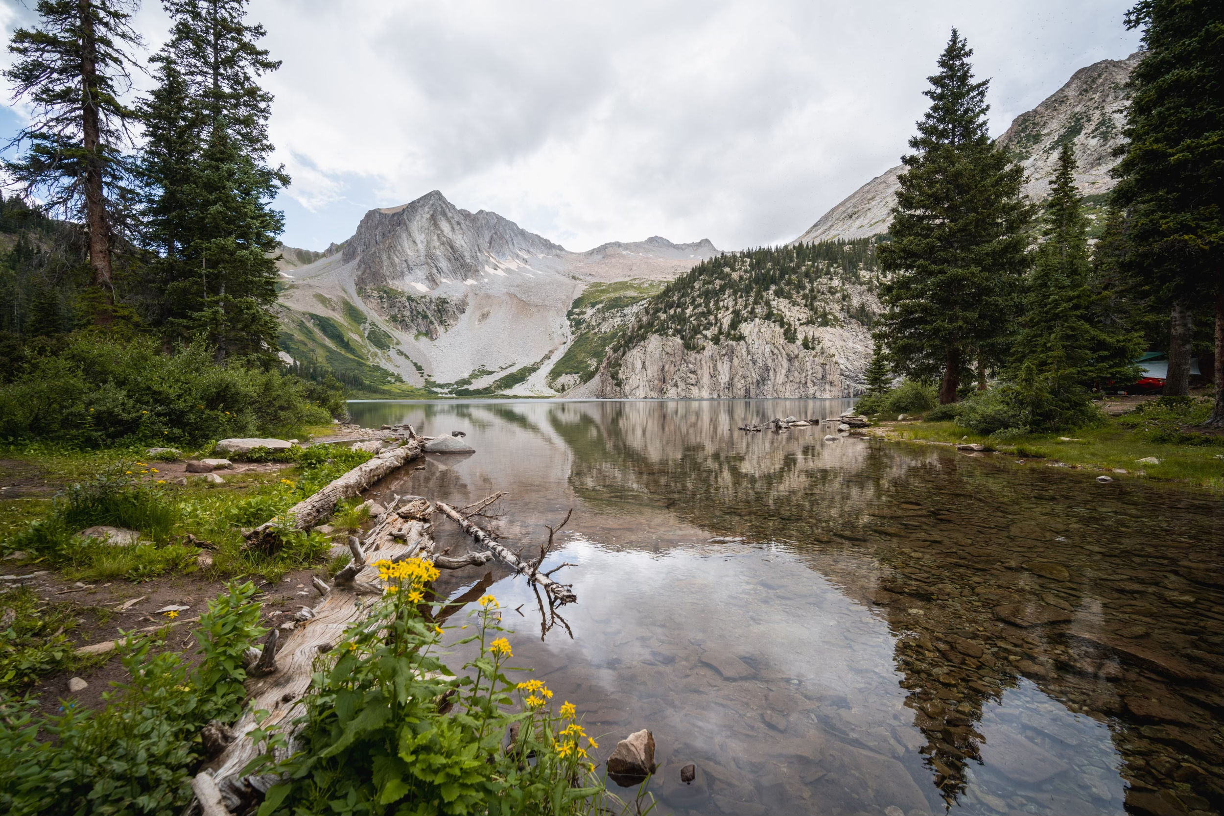
Back down to treeline, I followed the trail downhill towards my destination for the night, Crater Lake. As I walked down trail, 14ers Maroon Peak and North Maroon Peak towered over me on the left.
Night one I stayed at Crater Lake Campsite 7 which had at least a few flat, dry spots for tenting. There’s also a nearby stream which was quite convenient.
The skies threatened precip most of the evening with dark clouds swirling overhead. Despite the moody sky, light rain was all that I could remember before dozing off to the fading-in-frequency ‘POP’ noises of raindrops hitting the tent.
Day 2
Distance // 8.55 miles
Ascent // 2,756 feet
Points of interest // Buckskin Pass (12,462 ft elevation), Snowmass Lake
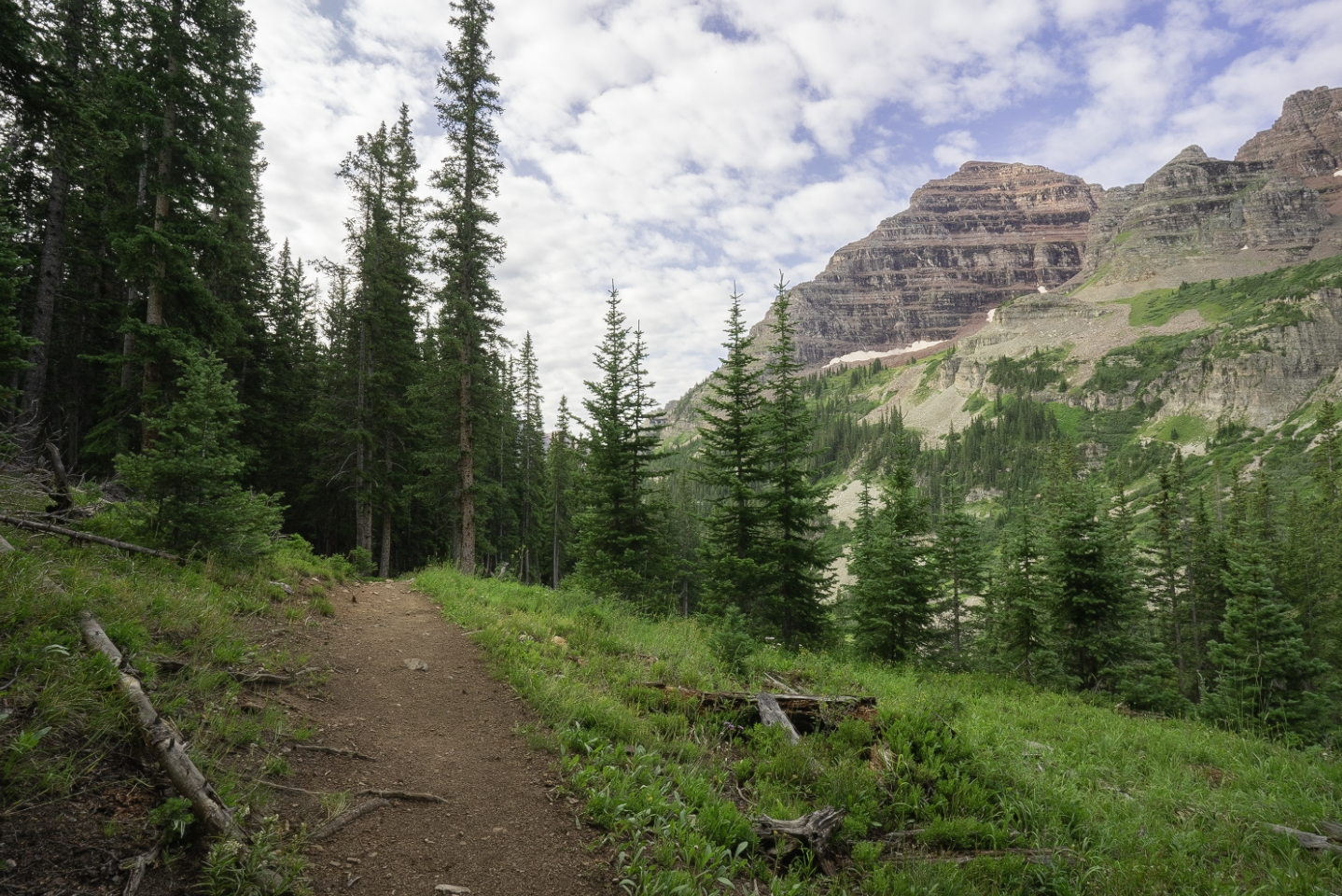
Broke camp around 7:20 am and was on my way shortly thereafter. Today’s goal was to make it to Snowmass Lake where I’d look for suitable campsite accommodations. After leaving camp, I followed the West Maroon Trail for a brief moment towards and around Crater Lake before turning onto Maroon-Snowmass Trail which I followed up into the woods heading in the rough direction of the second pass, Buckskin.
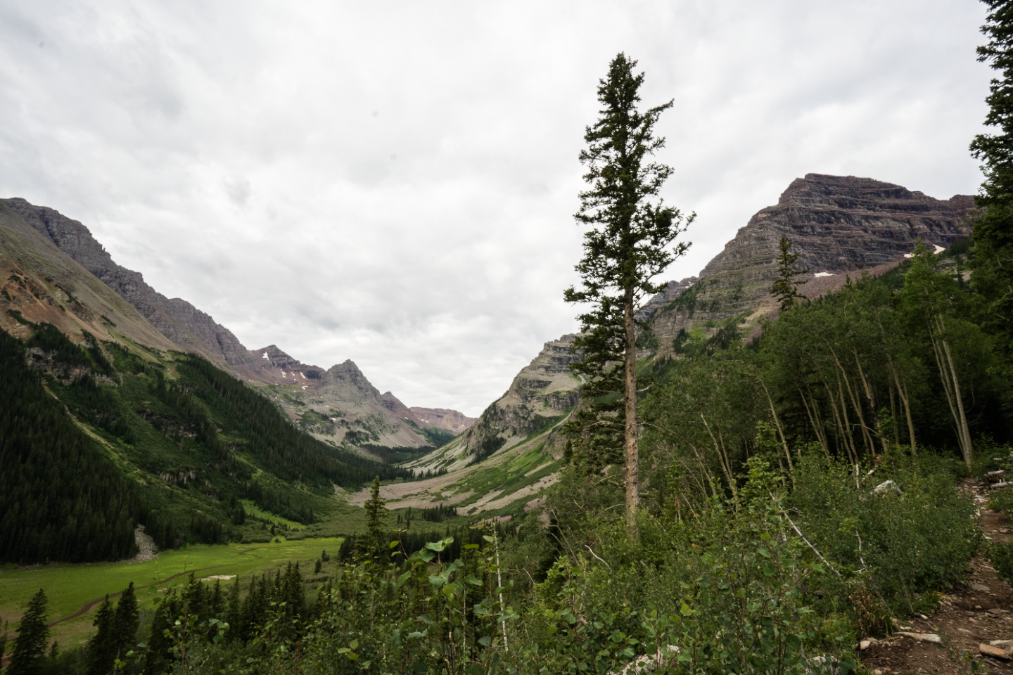
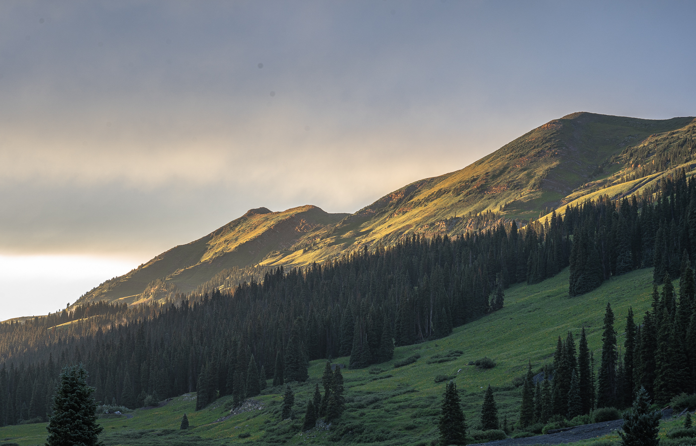
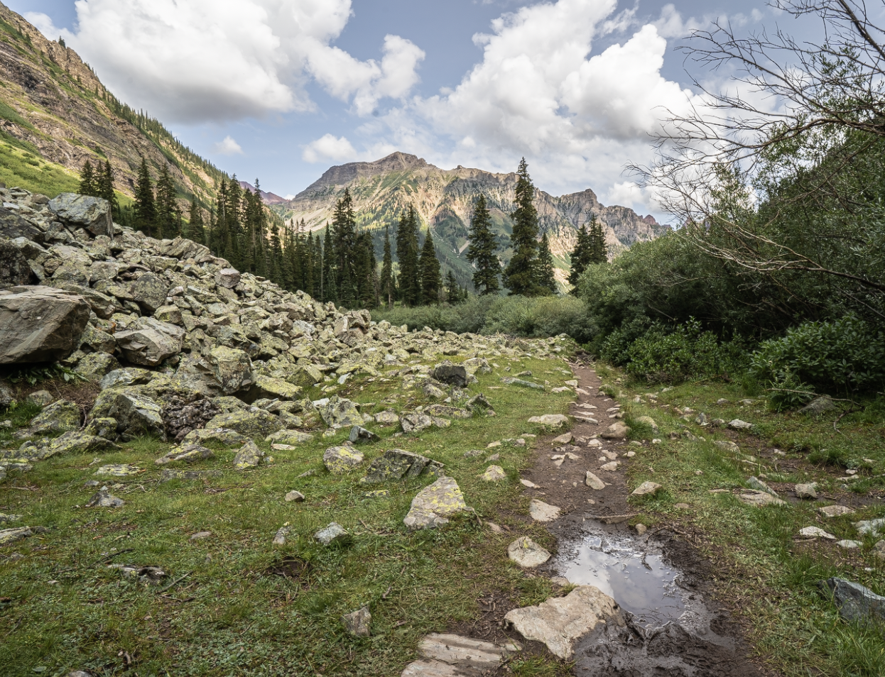
Climbing Buckskin Pass first thing in the morning was fun. It switches uphill through the Minehaha Gulch, at times steeply, through thick woods of spruce and aspen before opening up to some of your first views of the pass.
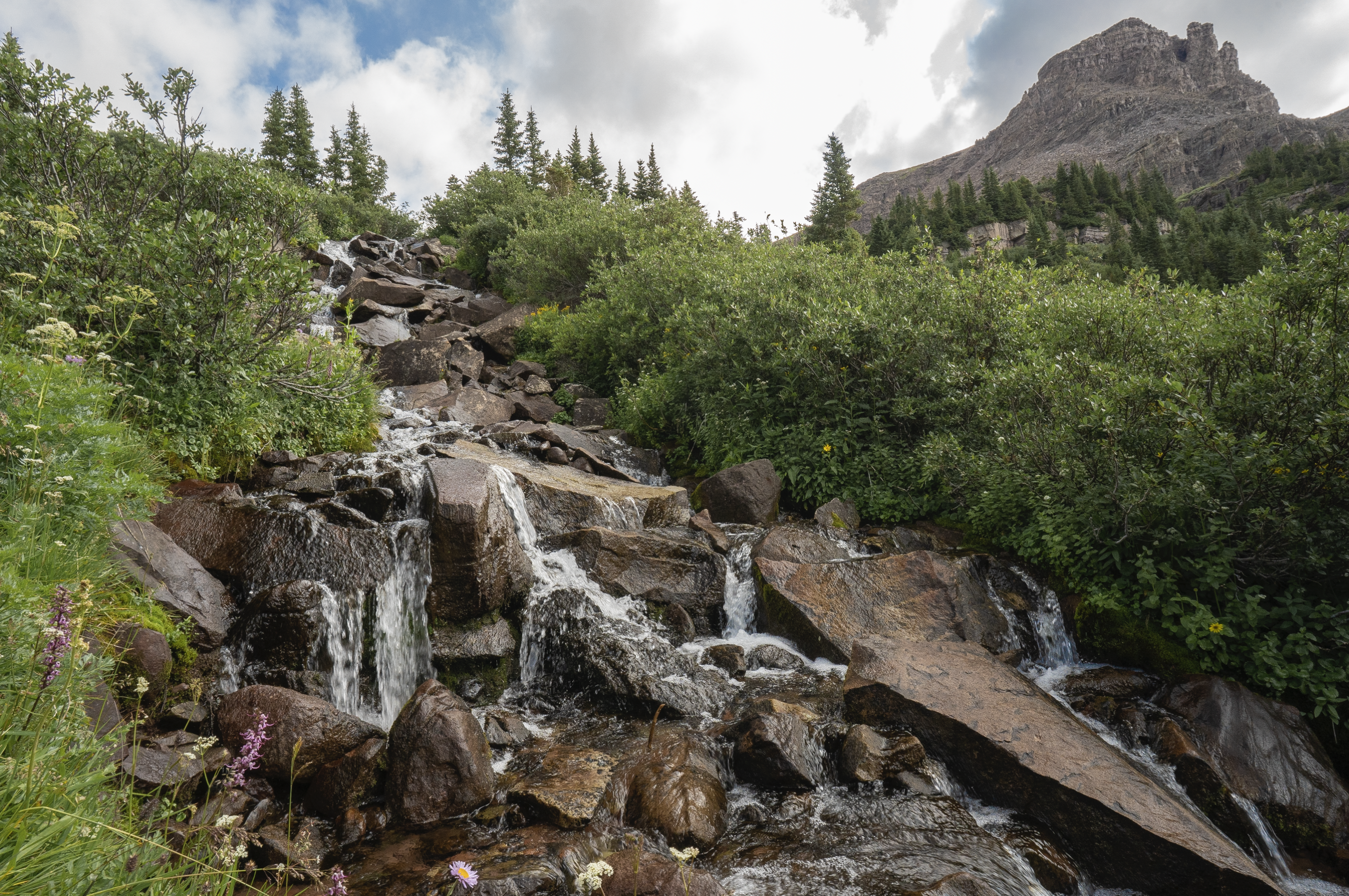
After leaving treeline, a massive drainage basin was all that stood between me and summiting Buckskin. On the way up, I crossed over a stream with nearby cascades where I took a quick break to apply sunscreen and camel up on water. The sun was out in full force at this point in the day.
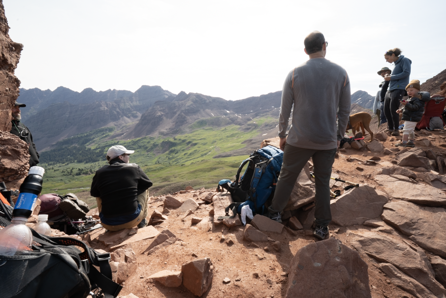
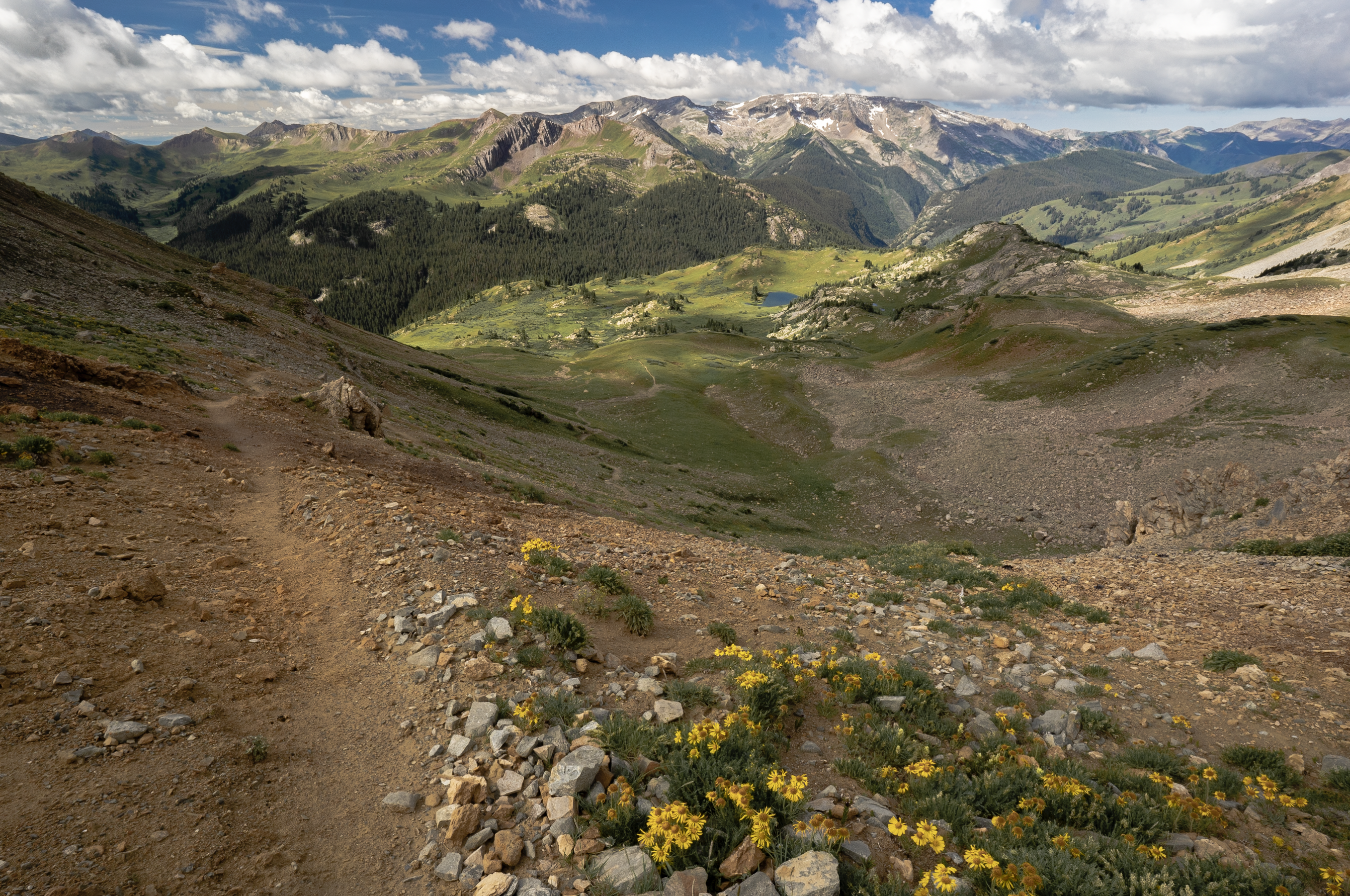
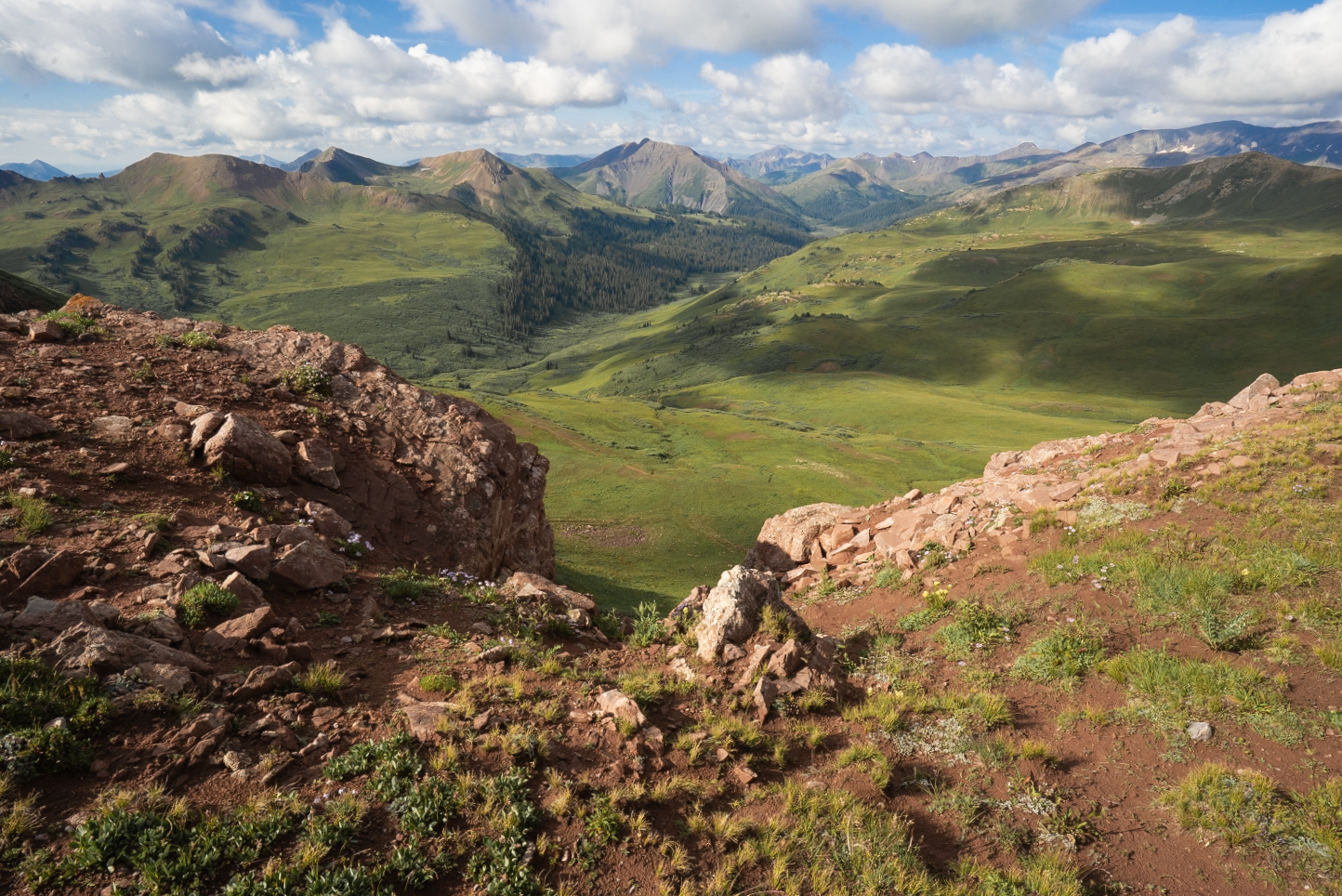
After what seemed like a couple dozen switchbacks, I made my final ascent atop the pass. I was greeted by a stunning 360 degree view of the surrounding mountains including Snowmass Mountain, Hagerman Peak, Capitol Peak, and Pyramid Peak among countless others.
After taking in the views over a protein bar, I began my descent down into the next basin towards Snowmass Lake which could be seen in the distance from atop Buckskin.
Arriving through the woods to Snowmass Lake was quite the site with the mountains and lake sparkling under mostly sunny skies. I was able to setup camp towards the quieter back corner where I had quick access to a beautiful lakeside view with Hagerman Peak on the opposite side.
I decided to cook early as clouds moved in from across the lake and appeared ready to open up. Good move as just as the food hydrated and was ready to eat, it began to rain. Then pour. Then hail. This would last most of the afternoon and into the evening. I spent this time waiting for what never happened: the rain to stop.
As I lay in the tent, I drifted off only to briefly wake up around 11:45 pm to silent woods and no rain. I rolled over and fell back asleep.
Day 3
Distance // 7.89 miles
Ascent // 2,152 feet
Points of interest // Trail Rider Pass (12,415 ft elevation), Fravert Basin
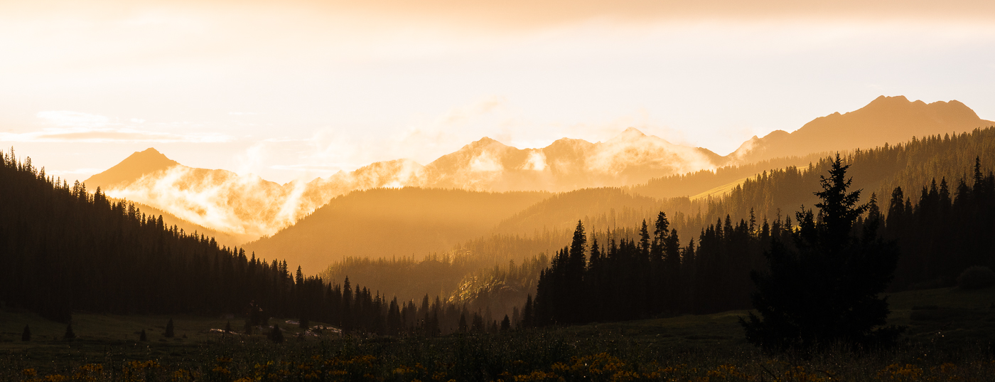
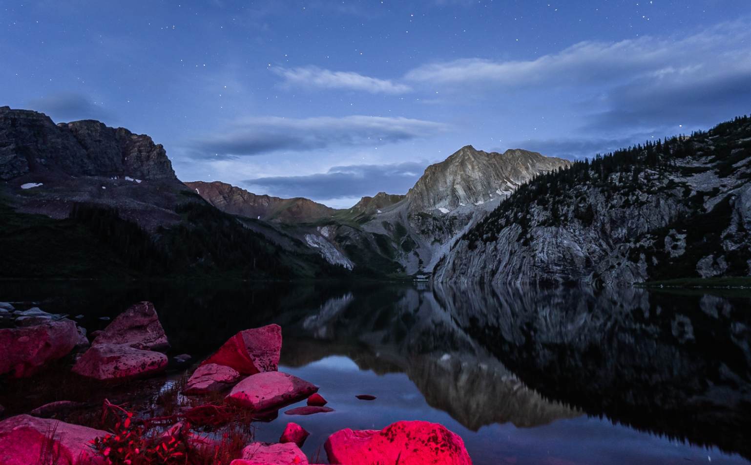
Woke up around 4 am a bit restless as I had been in my tent going on 12 hours. Skies were clear and the stars were out in full force. I decided to make a coffee and enjoy the still early morning by the lake which I might’ve had to my conscious self. At one point, the peace and quiet was interrupted by a nearby rock fall which sent reverberations and echoes of thunder throughout the area. I attempted some astro photography for a bit as the morning light changed and brightened.
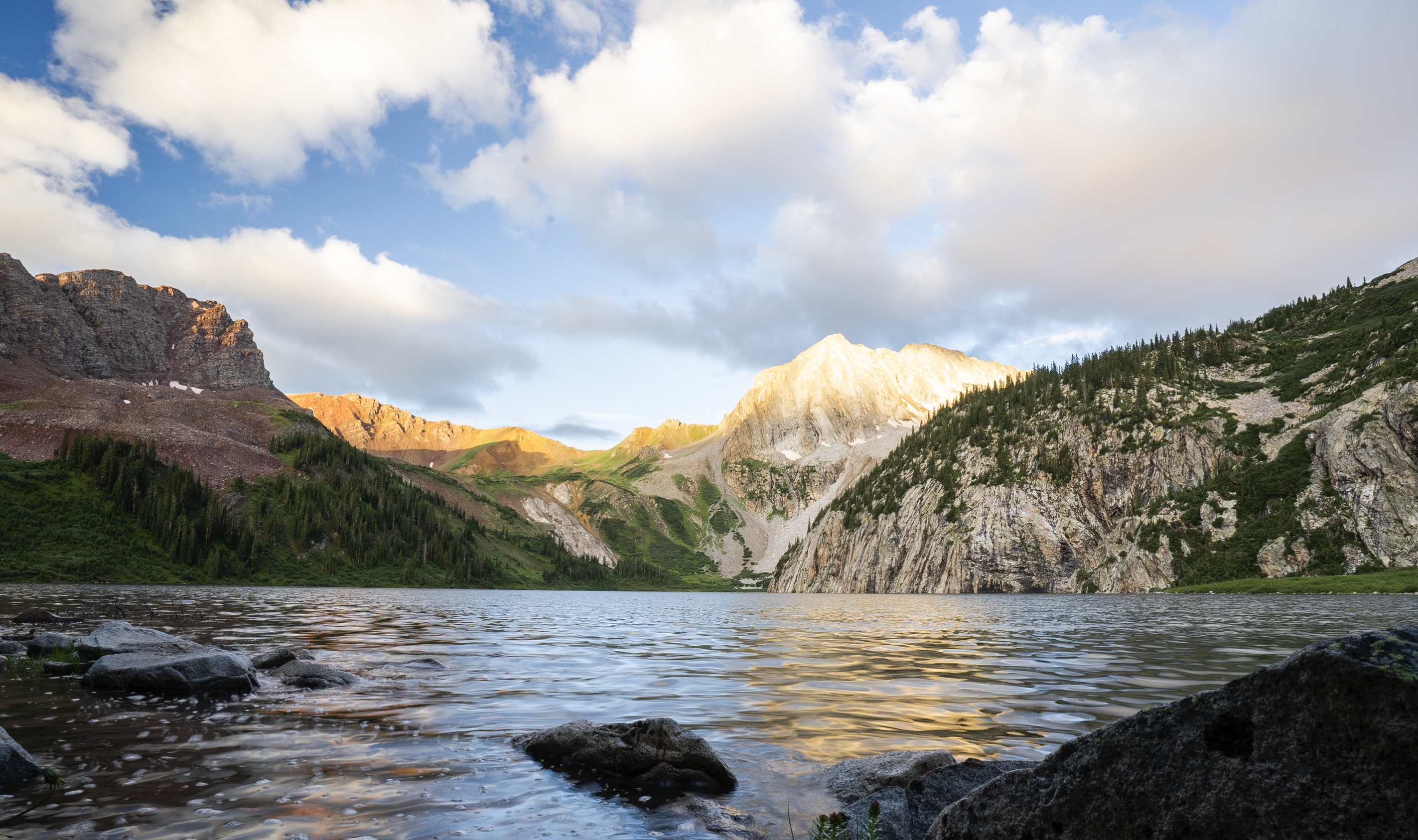
After watching the warm morning glow sweep over the mountains across the lake, I began to break camp and prepare to continue my journey. I started to make my way out of the Snowmass Camp area around quarter til 8.
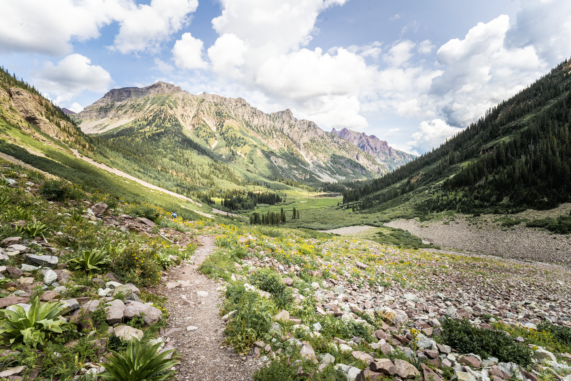
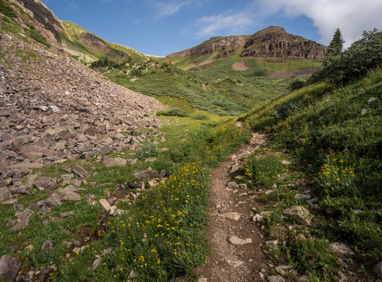
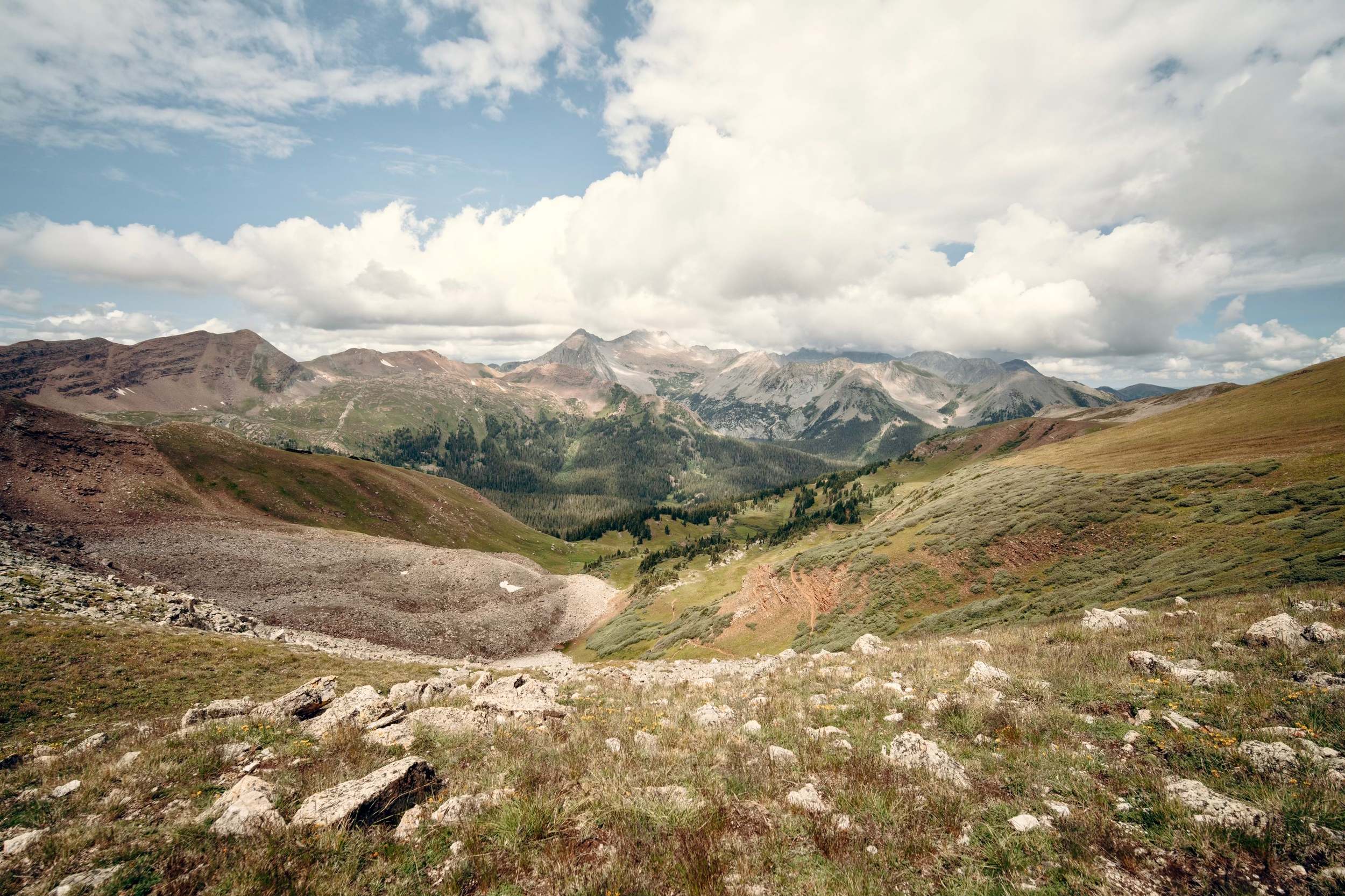
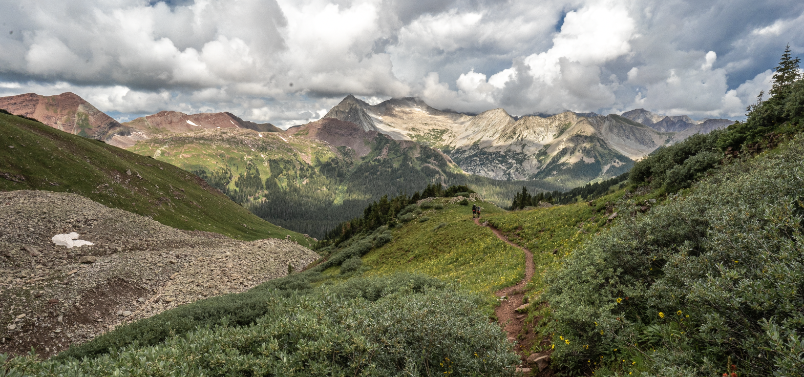
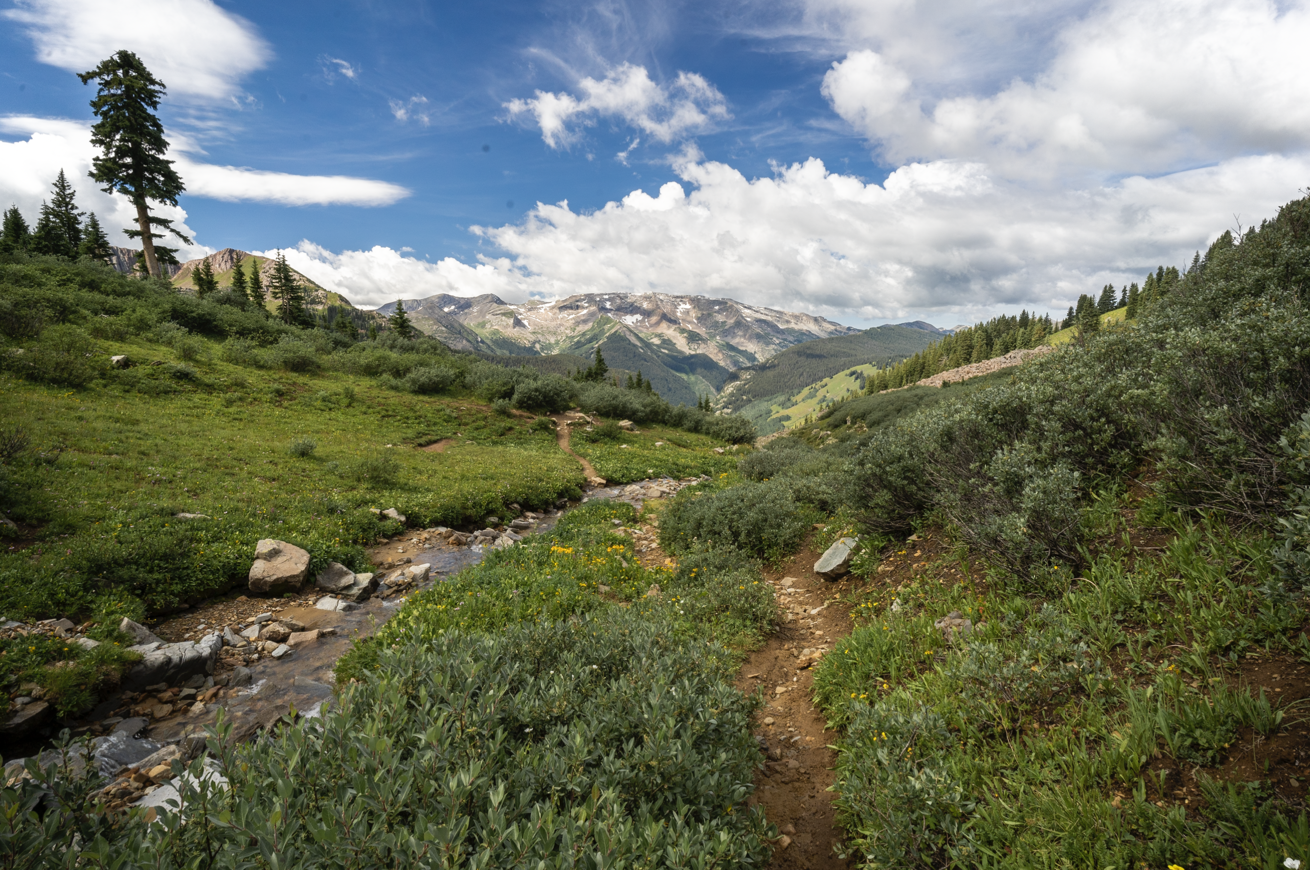
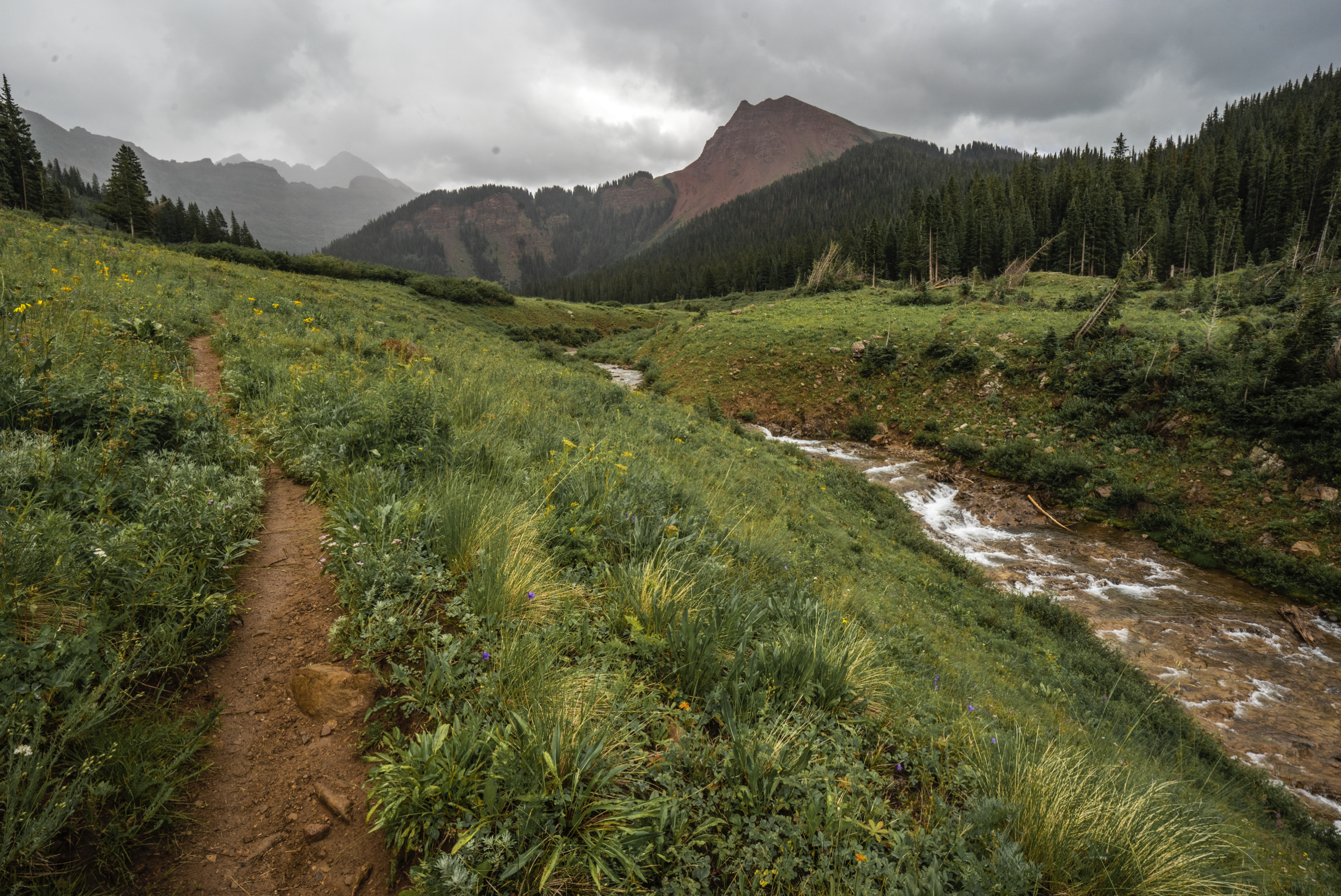
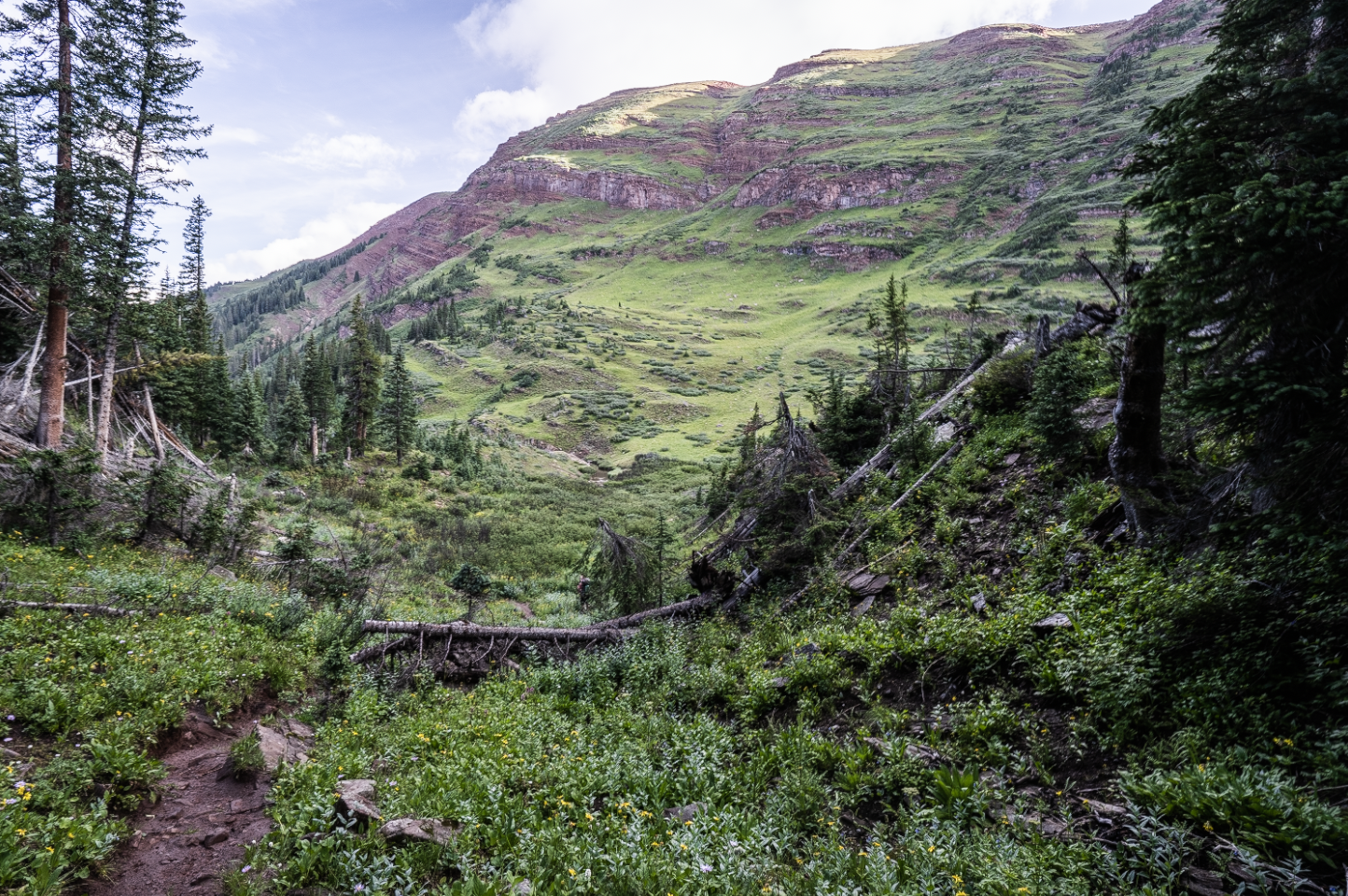
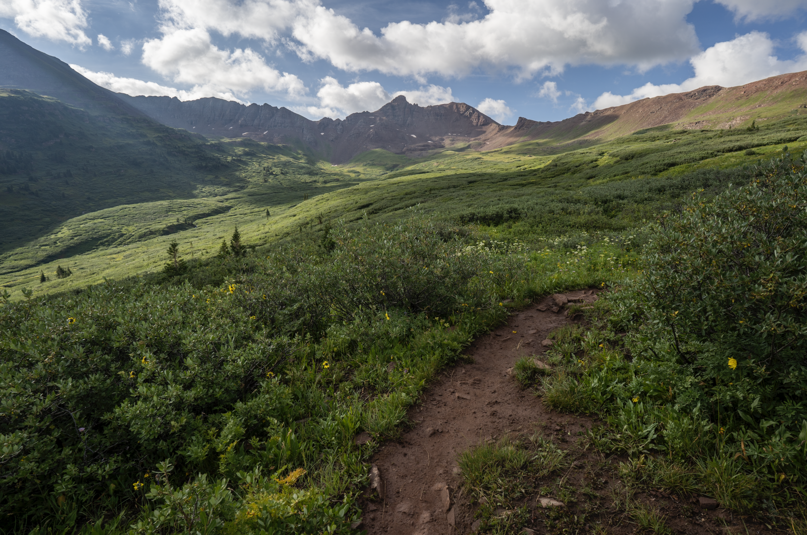
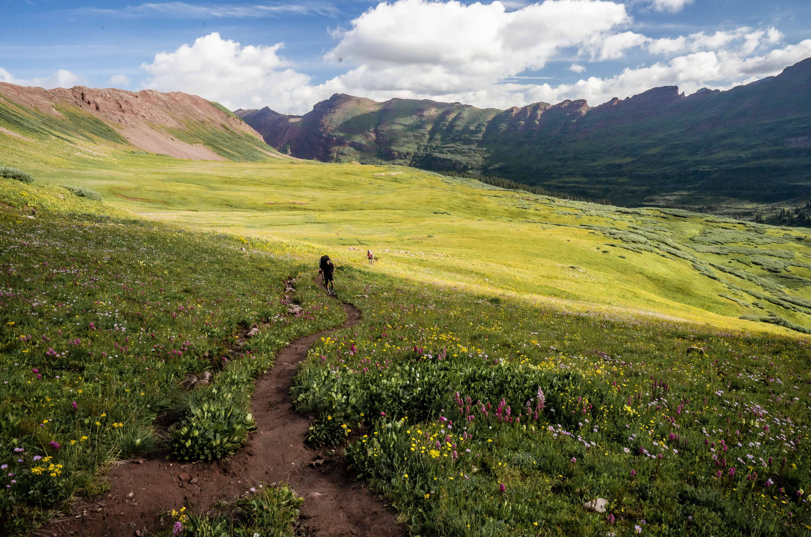
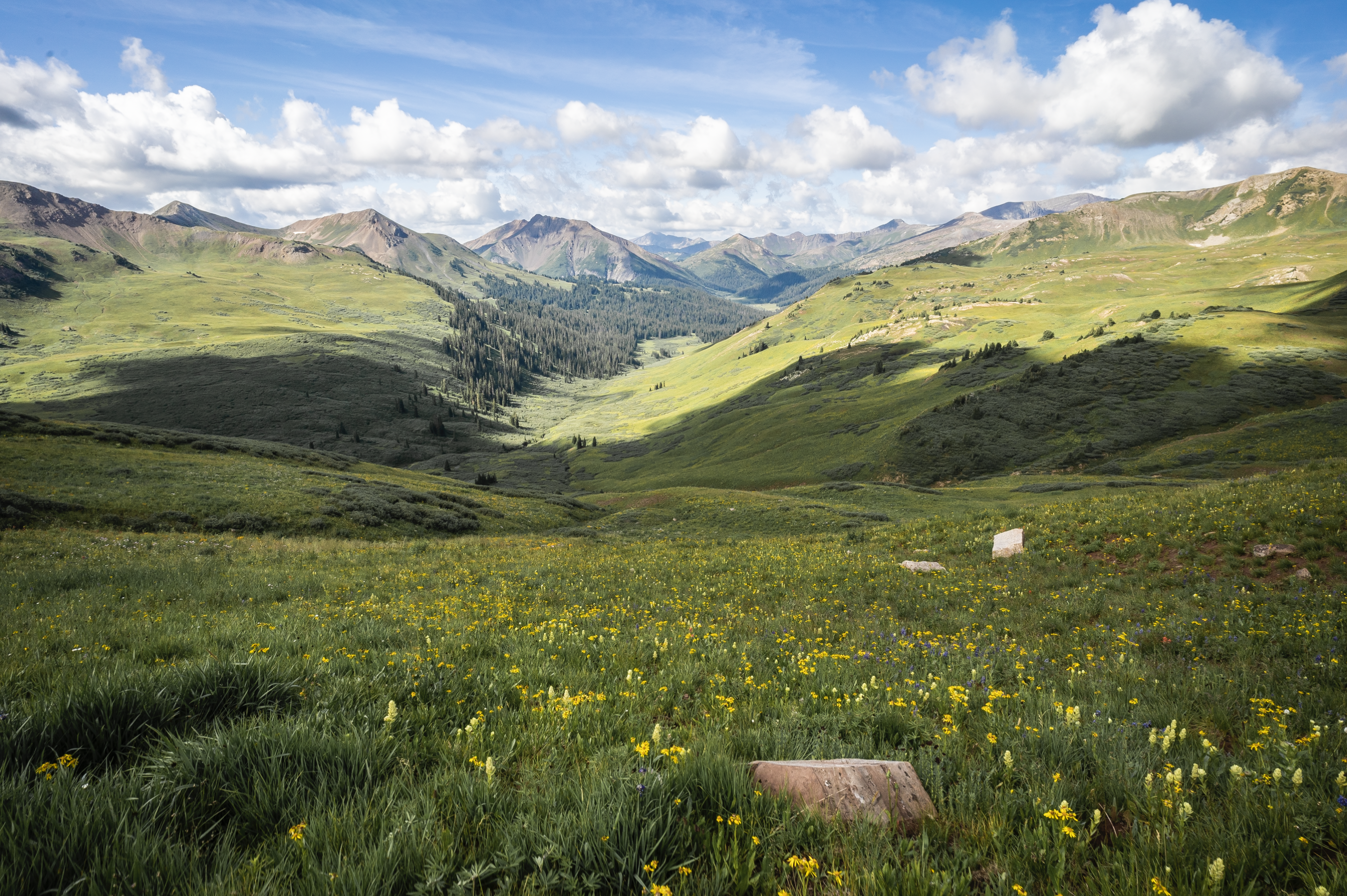
My goal today was to cross the third pass, Trailrider, and find camp somewhere around a large waterfall in the Fravert Basin. I followed Geneva Lake Trail towards the pass under partly sunny skies.
The approach up to Trailrider was fairly straight forward with only the scree field above the lake being the trickiest part. As I hiked towards the pass, it was hard to resist turning back towards the lake every other minute to soak in the views and take in the feeling of progress.
Once atop the pass, I enjoyed another spectacular panorama mountain view and devoured a protein bar. Apparently I was lucky to summit when I did as the pass would later be socked in by rain.
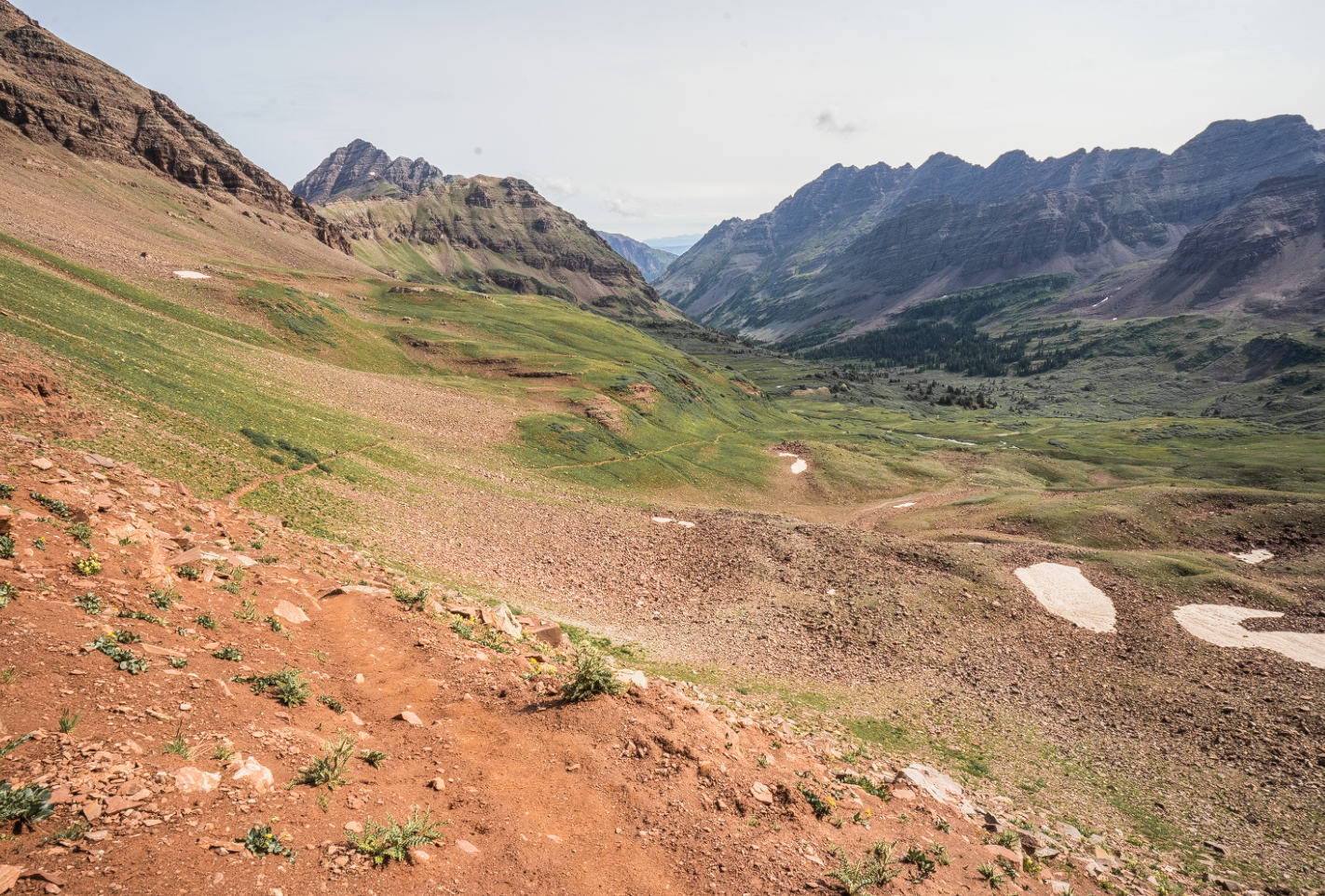
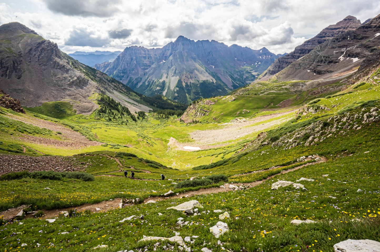
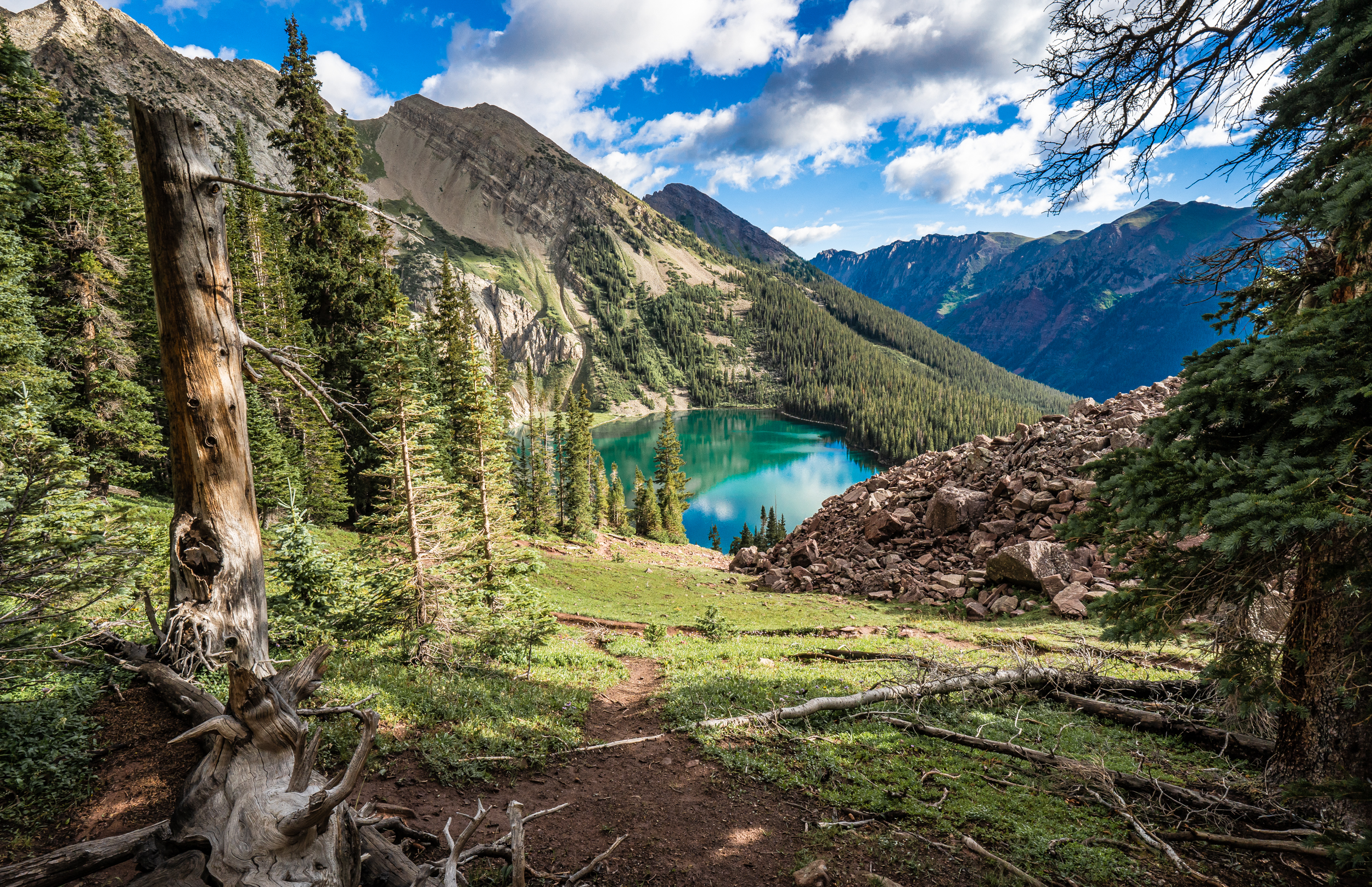
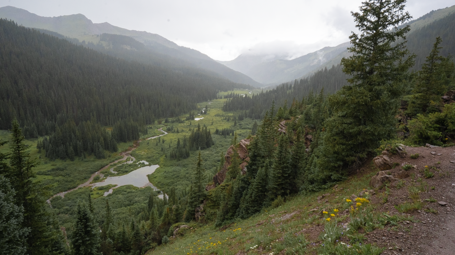
Coming down off the pass was steep but wasn’t too bad as long as you’re careful. Once down from the pass the grade slopes to a flat meadow area where there is a picturesque alpine lake (or pond?). Shortly after passing the small lake, I turned onto North Fork Cutoff Trail from Geneva Lake Trail where I began the descent into Fravert Basin.
Light rain started to fall upon my arrival to the bottom of the basin. I ducked under a pocket of conifer trees and ate a snack while taking in my surroundings. Opposite of me across the basin was the large waterfall which I began to move towards after deciding to move on.
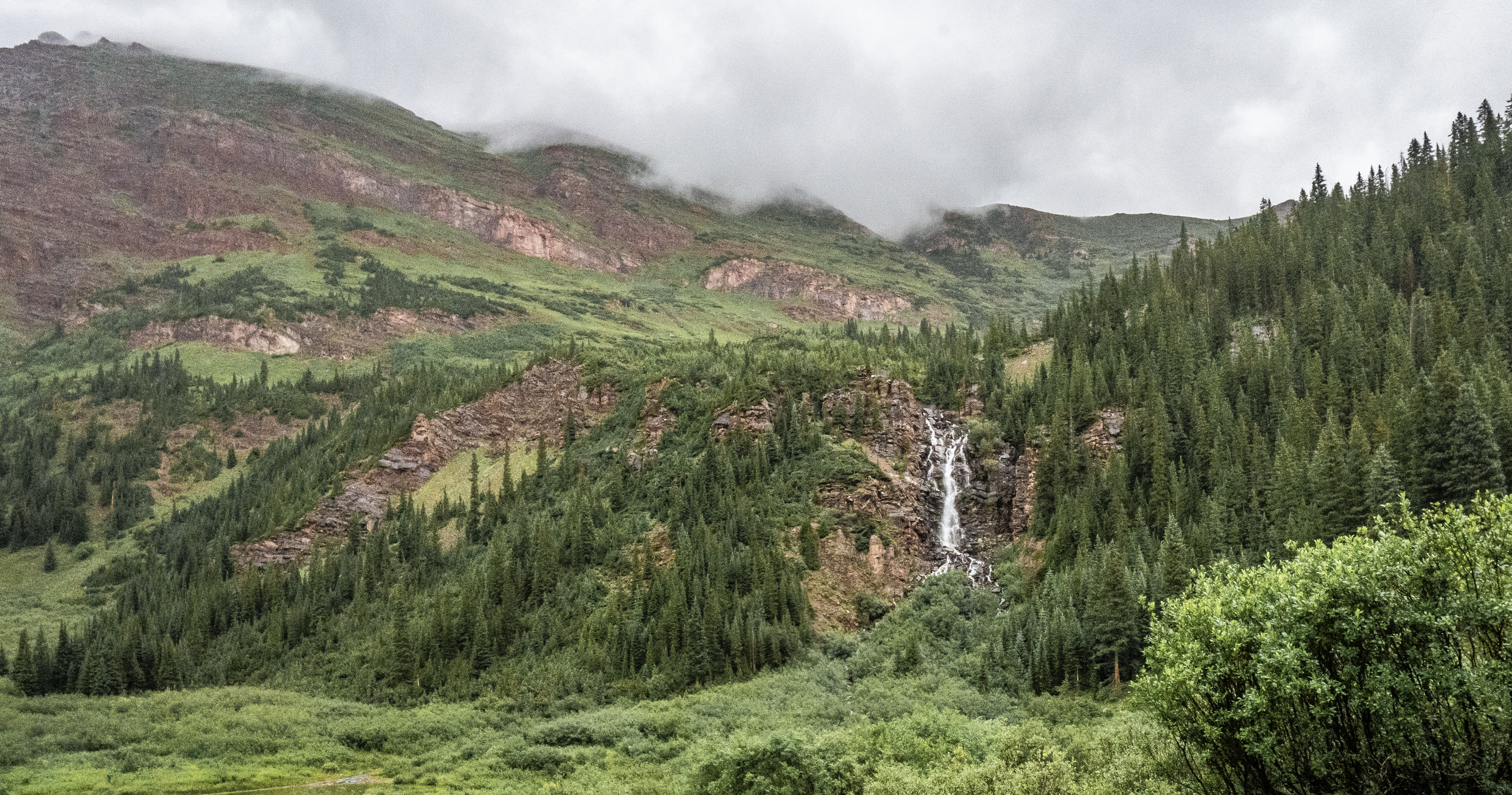
After reaching the other side of the basin, I climbed up to the top of the area adjacent to the waterfall. There were many scenic views of the basin up there as well as a series of cascades that fed the waterfall. In this area I was able to find a suitable campsite with dry flat spots and a large fire pit which I would use this night. Outside of a few drizzles, the rain stopped earlier in the evening.
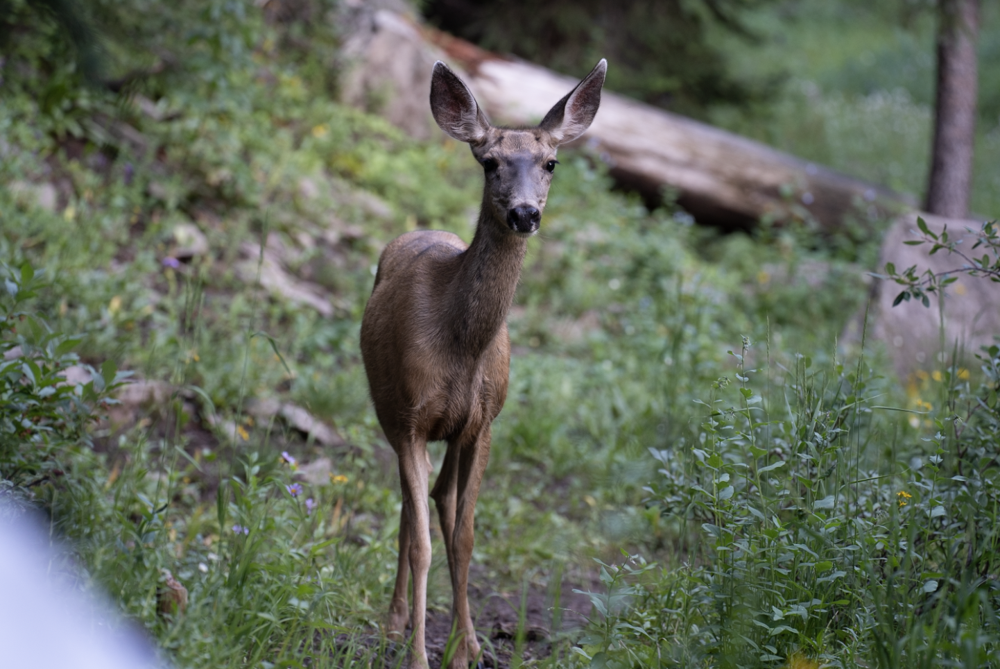
Habituated deer visited often as I did my camp chores and ate. It appeared they wanted some food as they nervously watched me move about camp from the nearby brush.
Stayed up too late tending the fire but it was worth it as it was a nice evening. Not sure when I fell asleep, maybe 11:30ish?
Day 4 (final day)
Distance // 8.10 miles
Ascent // 1,686 feet
Points of interest // Trail Rider Pass (12,415 ft elevation), Fravert Basin
Woke up around 6 am to another group of hikers breaking camp. It was the last day of the trip so I took my time going through my morning routines before packing up and setting off around 7:30 am.
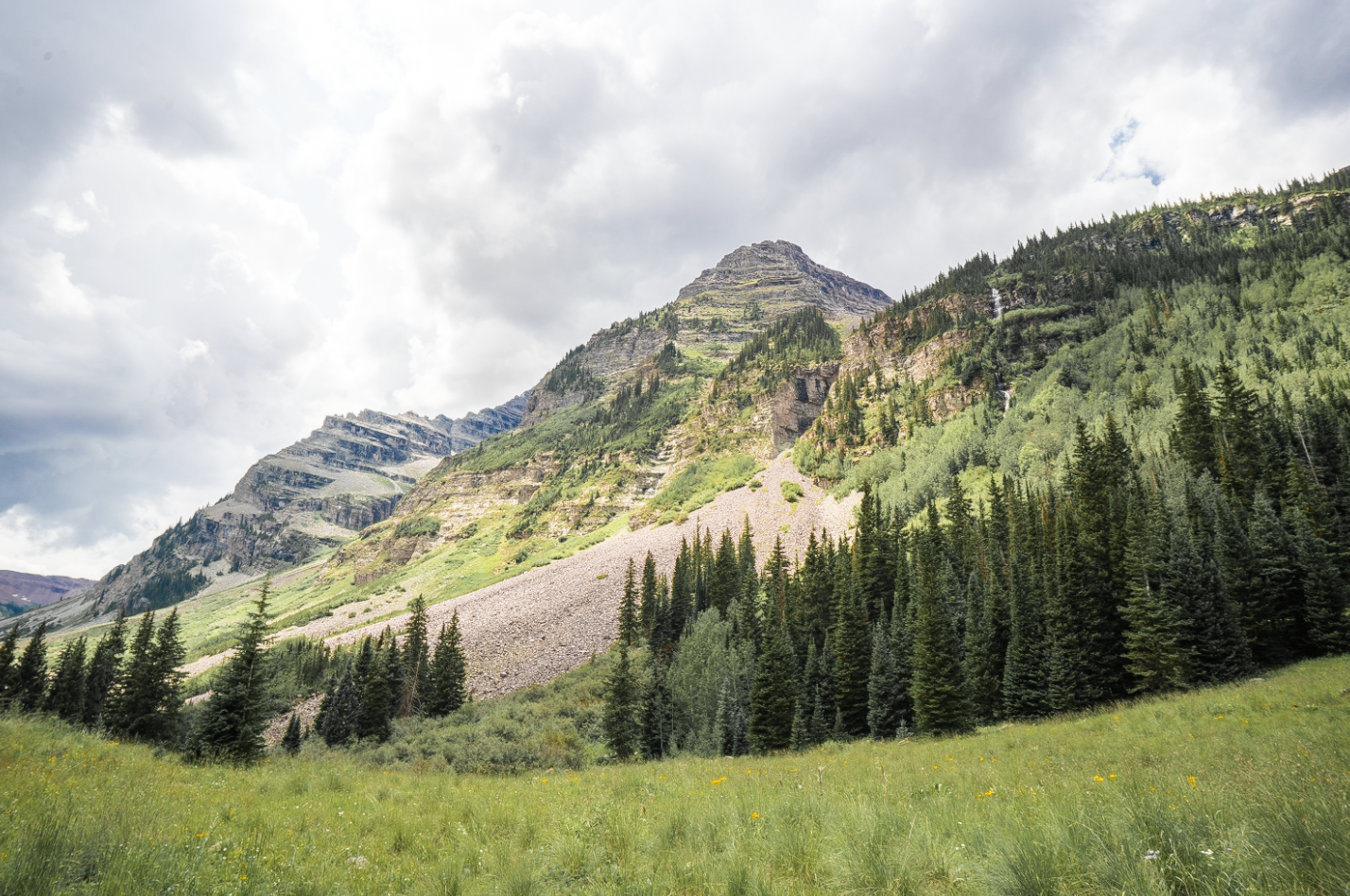
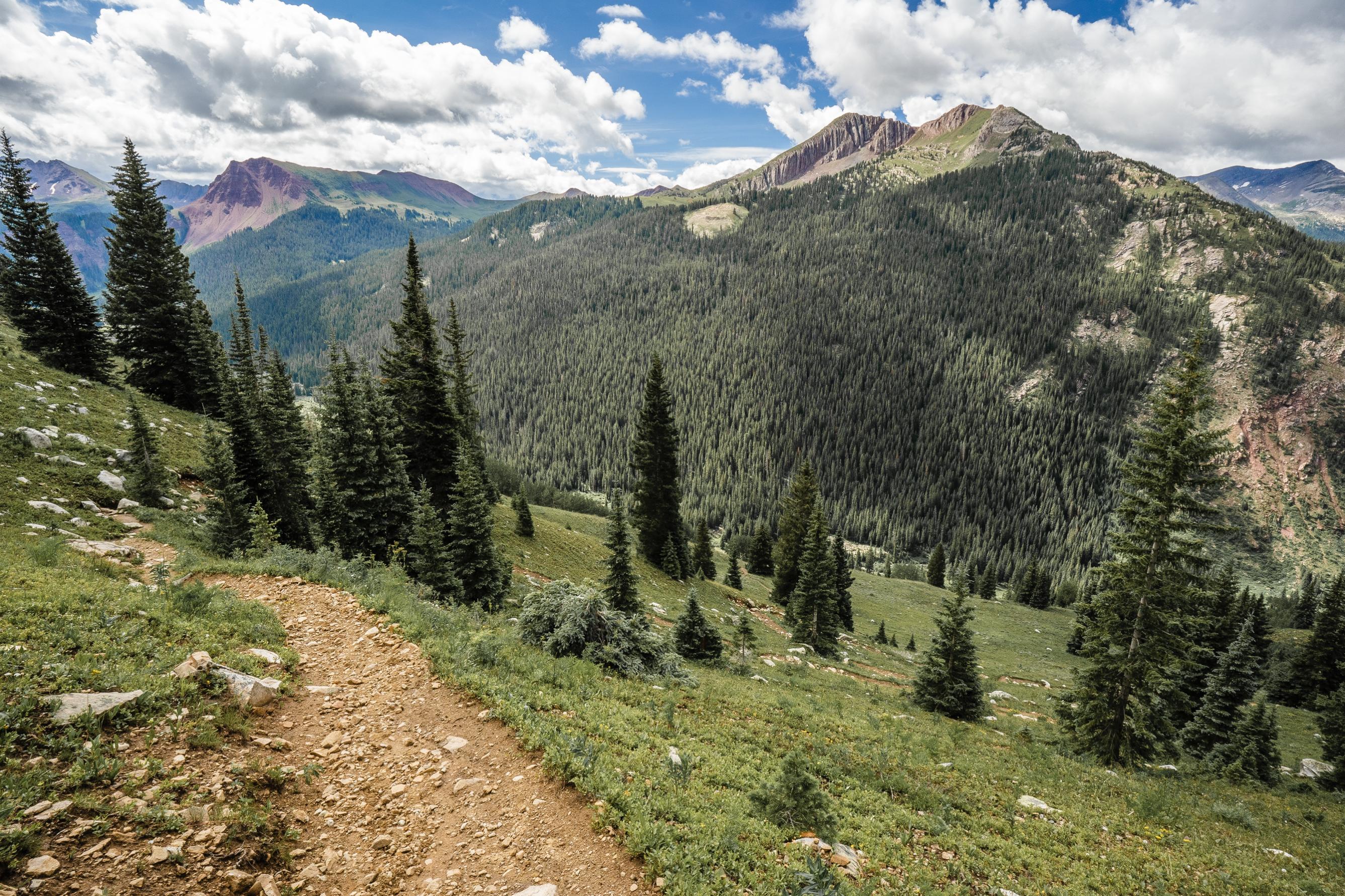
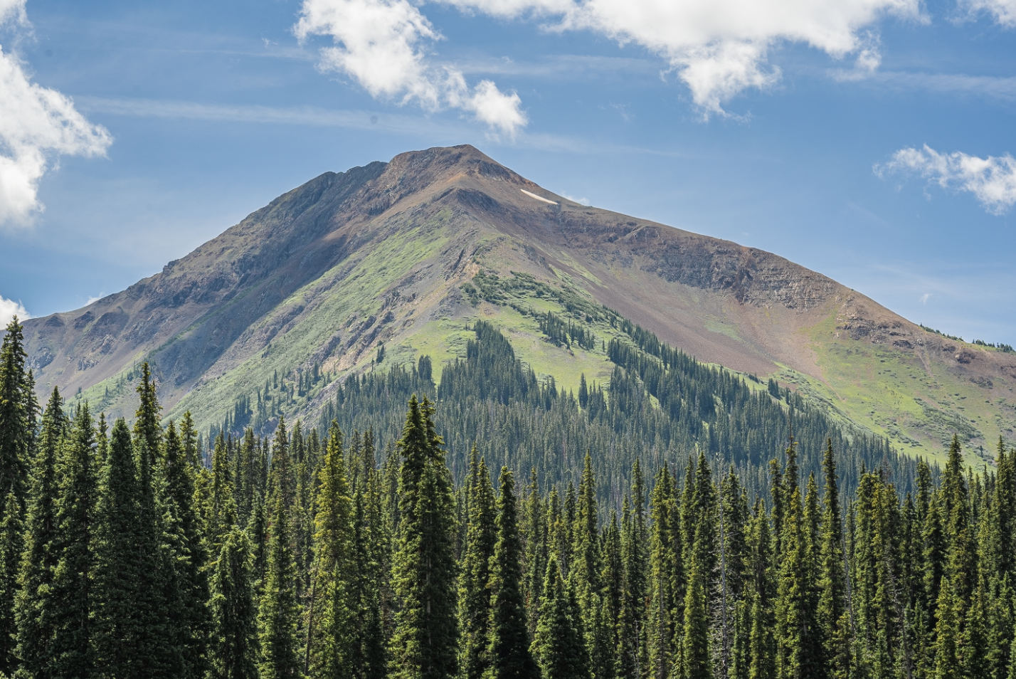
I started back on the North Fork Crystal River Trail and made my way towards the last pass, Frigid Air. Walking below lush green mountain slopes adorned with waterfalls, I was reminded of the movie Jurassic Park.
The last day was mostly sunny and perfect weather for hiking. The grade towards the final pass was fairly easy especially after having gained my hiking legs on the other 3 passes.
I took my time moving up Frigid Air to soak it all in. Shortly after summiting, I celebrated the accomplishment of traversing all four passes with a protein bar and exchanged a few high fives with fellow Four Pass Loopers.
After enjoying the top of the pass for a little while, I began the final descent back down to the car. Turning back on to West Maroon Trail from North Fork Crystal River Trail to complete the final leg, I reflected on the trip and thought about what I would eat once back in town.
Final thoughts
Overall, everything went as planned. Weather was great for a rainy monsoon season. Gear worked out and I used everything I carried. Fitness was on point. No altitude sickness. If there was one thing I’d maybe do different next time, it would be to push over Trail Rider Pass on day two and head over to Geneva Lake for camp. This said, I would’ve been caught in rain and hail, possibly while on the pass, so it worked out in the end.
One thing I was not happy to see was signs of excessive human visitation. Some areas, like Snowmass Lake, were in pretty bad shape as human waste and general landscape degradation had taken a toll. Given the need to conserve what we have left on this planet, it’s always a good idea to practice Leave No Trace. Plan ahead and prepare by knowing the regulations of the area you’re visiting. Pack out what you pack in and also leave what you find. Limit group size when possible. Respect wildlife. These are a few things you can do to reduce your impact.
The Four Pass Loop has been on my bucket list for a few years now and it lived up to the hype. I really can’t recommend this trail enough. Though difficult it’s extremely rewarding in the views and experiences it offers. From the beautiful meadows to the sweeping panoramas to the rushing mountain streams, I enjoyed every moment of my experience.